Area Overview for LU7 0NJ
Photos of LU7 0NJ

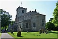
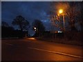
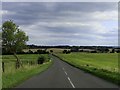


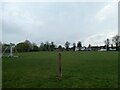
100 photos from this area
Area Information
Key information about the LU7 0NJ including its size, population, and administrative classification.
- Area Type
- Postcode
- Area Size
- 6954 m²
- Population
- 1645
- Population Density
- 101 people/km²
House Prices in LU7 0NJ
20
Properties
£236,761
Average Sold Price
£84,950
Lowest Price
£558,000
Highest Price
Showing 20 properties
| Address | Type | Beds | Baths | Last Sale Price | Last Sale Date | |
|---|---|---|---|---|---|---|
| 3 Stewkley Road, Wing, LU7 0NJ | Terraced | 2 | 1 | £177,207 | Jan 2025 | |
| 39 Stewkley Road, Wing, LU7 0NJ | Terraced | 2 | 1 | £217,000 | Dec 2019 | |
| 11 Stewkley Road, Wing, LU7 0NJ | Terraced | 2 | 1 | £235,000 | Jan 2019 | |
| 43 Stewkley Road, Wing, LU7 0NJ | house | 2 | - | £285,000 | May 2018 | |
| 23 Stewkley Road, Wing, LU7 0NJ | Semi-detached | 3 | 1 | £558,000 | Nov 2016 | |
| 25 Stewkley Road, Wing, LU7 0NJ | house | - | - | £440,000 | Aug 2016 | |
| 27 Stewkley Road, Wing, LU7 0NJ | house | - | - | £190,000 | Feb 2013 | |
| 5A Stewkley Road, Wing, LU7 0NJ | house | 2 | - | £200,000 | Jun 2012 | |
| 5 Stewkley Road, Wing, LU7 0NJ | house | 2 | - | £211,500 | Jun 2012 | |
| 35 Stewkley Road, Wing, LU7 0NJ | house | - | - | £184,000 | Jun 2012 |
Page 1 of 2
Energy Efficiency in LU7 0NJ
Amenities
Schools
| Rank | School | Type | Entry gender | Ages |
|---|
Explore more schools in this area
Go to Schools tabDemographics
Household Size
Family (3-5 people)
most common
Accommodation Type
Houses
most common
Tenure
85
majority
Ethnic Group
White
most common
Religion
N/A
most common
Household Composition
N/A
most common
Age
47
median
Adults (30-64 years)
most common
Household Deprivation
N/A
with no deprivation
NS-SEC
44
in Lower managerial occupations
Explore more demographic insights in this area
Go to Demographics tabPlanning
Planning Constraints
- Flood RiskPremium
- Ramsar Wetland SitesPremium
- Area of Outstanding Natural BeautyPremium
- Protected Nature ReservePremium
- Protected WoodlandPremium