Area Overview for LU7 0NE
Photos of LU7 0NE

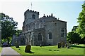
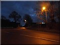
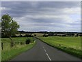
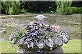

100 photos from this area
Area Information
Key information about the LU7 0NE including its size, population, and administrative classification.
- Area Type
- Postcode
- Area Size
- 1.5 hectares
- Population
- 1334
- Population Density
- 403 people/km²
House Prices in LU7 0NE
25
Properties
£281,625
Average Sold Price
£55,000
Lowest Price
£575,000
Highest Price
Showing 25 properties
| Address | Type | Beds | Baths | Last Sale Price | Last Sale Date | |
|---|---|---|---|---|---|---|
| 44 Stewkley Road, Wing, LU7 0NE | Semi-detached | 3 | 1 | £445,000 | Jul 2025 | |
| 2 Stewkley Road, Wing, LU7 0NE | Semi-detached | 4 | 1 | £386,000 | Nov 2024 | |
| 30 Stewkley Road, Wing, LU7 0NE | Bungalow | 5 | 4 | £575,000 | Oct 2023 | |
| 52 Stewkley Road, Wing, LU7 0NE | house | - | - | £340,000 | Jun 2021 | |
| 50 Stewkley Road, Wing, LU7 0NE | Semi-detached | 3 | 2 | £270,000 | Dec 2020 | |
| 34 Stewkley Road, Wing, LU7 0NE | Bungalow | - | - | £555,000 | Aug 2020 | |
| 42 Stewkley Road, Wing, LU7 0NE | Semi-detached | 4 | 2 | £260,000 | Dec 2017 | |
| 54 Stewkley Road, Wing, LU7 0NE | Detached | 3 | 2 | £337,500 | Dec 2016 | |
| 22 Stewkley Road, Wing, LU7 0NE | Semi-detached | 2 | - | £227,500 | Feb 2015 | |
| 2B Stewkley Road, Wing, LU7 0NE | Maisonette | 1 | - | £117,500 | Nov 2014 |
Page 1 of 3
Energy Efficiency in LU7 0NE
Amenities
Schools
| Rank | School | Type | Entry gender | Ages |
|---|
Explore more schools in this area
Go to Schools tabDemographics
Household Size
Family (3-5 people)
most common
Accommodation Type
Houses
most common
Tenure
60
majority
Ethnic Group
White
most common
Religion
N/A
most common
Household Composition
N/A
most common
Age
47
median
Adults (30-64 years)
most common
Household Deprivation
N/A
with no deprivation
NS-SEC
36
in Lower managerial occupations
Explore more demographic insights in this area
Go to Demographics tabPlanning
Planning Constraints
- Flood RiskPremium
- Ramsar Wetland SitesPremium
- Area of Outstanding Natural BeautyPremium
- Protected Nature ReservePremium
- Protected WoodlandPremium