Area Overview for KT8 2LX
Photos of KT8 2LX
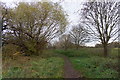
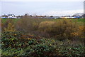
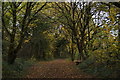
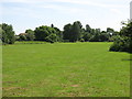
40 photos from this area
Area Information
Key information about the KT8 2LX including its size, population, and administrative classification.
- Area Type
- Postcode
- Area Size
- 3.9 hectares
- Population
- 1860
- Population Density
- 5177 people/km²
House Prices in KT8 2LX
47
Properties
£314,627
Average Sold Price
£55,000
Lowest Price
£600,000
Highest Price
Showing 47 properties
| Address | Type | Beds | Baths | Last Sale Price | Last Sale Date | |
|---|---|---|---|---|---|---|
| 130 High Street, West Molesey, KT8 2LX | Terraced | 3 | 1 | £387,000 | Sep 2025 | |
| 178 High Street, West Molesey, KT8 2LX | Terraced | 4 | 2 | £540,000 | Aug 2025 | |
| 172 High Street, West Molesey, KT8 2LX | house | 3 | 2 | £475,000 | Feb 2025 | |
| 166 High Street, West Molesey, KT8 2LX | Terraced | 2 | 1 | £400,000 | Sep 2023 | |
| 152A High Street, West Molesey, KT8 2LX | Terraced | 3 | 2 | £558,000 | Jun 2022 | |
| 158 High Street, West Molesey, KT8 2LX | Retail | 2 | 1 | £390,000 | Apr 2022 | |
| 152 High Street, West Molesey, KT8 2LX | house | - | - | £600,000 | Apr 2022 | |
| 136 High Street, West Molesey, KT8 2LX | house | 2 | 1 | £360,000 | Jan 2022 | |
| 156 High Street, West Molesey, KT8 2LX | house | - | - | £373,950 | Sep 2021 | |
| 190 High Street, West Molesey, KT8 2LX | house | - | - | £405,000 | Jun 2021 |
Page 1 of 5
Energy Efficiency in KT8 2LX
Amenities
Schools
| Rank | School | Type | Entry gender | Ages |
|---|
Explore more schools in this area
Go to Schools tabDemographics
Household Size
Family (3-5 people)
most common
Accommodation Type
Houses
most common
Tenure
73
majority
Ethnic Group
White
most common
Religion
N/A
most common
Household Composition
N/A
most common
Age
47
median
Adults (30-64 years)
most common
Household Deprivation
N/A
with no deprivation
NS-SEC
44
in Lower managerial occupations
Explore more demographic insights in this area
Go to Demographics tabPlanning
Planning Constraints
- Flood RiskPremium
- Ramsar Wetland SitesPremium
- Area of Outstanding Natural BeautyPremium
- Protected Nature ReservePremium
- Protected WoodlandPremium