Area Overview for KT8 2HG
Photos of KT8 2HG
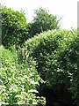
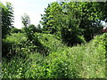
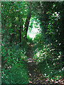
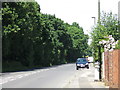
31 photos from this area
Area Information
Key information about the KT8 2HG including its size, population, and administrative classification.
- Area Type
- Postcode
- Area Size
- 1.1 hectares
- Population
- 1542
- Population Density
- 4584 people/km²
House Prices in KT8 2HG
29
Properties
£457,071
Average Sold Price
£250,000
Lowest Price
£625,000
Highest Price
Showing 29 properties
| Address | Type | Beds | Baths | Last Sale Price | Last Sale Date | |
|---|---|---|---|---|---|---|
| 9 Ivydene, West Molesey, KT8 2HG | Semi-detached | 4 | 3 | £625,000 | Sep 2024 | |
| 26 Ivydene, West Molesey, KT8 2HG | Semi-detached | 3 | 1 | £565,000 | Sep 2024 | |
| 36 Ivydene, West Molesey, KT8 2HG | house | 3 | - | £535,000 | Jun 2022 | |
| 6 Ivydene, West Molesey, KT8 2HG | house | - | - | £512,500 | Jan 2021 | |
| 5 Ivydene, West Molesey, KT8 2HG | Bungalow | 2 | - | £277,000 | Oct 2012 | |
| 1 Ivydene, West Molesey, KT8 2HG | Semi-detached | 1 | 2 | £435,000 | Oct 2009 | |
| 13 Ivydene, West Molesey, KT8 2HG | Semi-detached | - | - | £250,000 | Sep 2006 | |
| 10 Ivydene, West Molesey, KT8 2HG | Semi-detached | 4 | 2 | - | - | |
| 34 Ivydene, West Molesey, KT8 2HG | Semi-detached | 3 | 1 | - | - | |
| 20 Ivydene, West Molesey, KT8 2HG | Retail | 4 | 1 | - | - |
Page 1 of 3
Energy Efficiency in KT8 2HG
Amenities
Schools
| Rank | School | Type | Entry gender | Ages |
|---|
Explore more schools in this area
Go to Schools tabDemographics
Household Size
Family (3-5 people)
most common
Accommodation Type
Houses
most common
Tenure
74
majority
Ethnic Group
White
most common
Religion
N/A
most common
Household Composition
N/A
most common
Age
47
median
Adults (30-64 years)
most common
Household Deprivation
N/A
with no deprivation
NS-SEC
33
in Lower managerial occupations
Explore more demographic insights in this area
Go to Demographics tabPlanning
Planning Constraints
- Flood RiskPremium
- Ramsar Wetland SitesPremium
- Area of Outstanding Natural BeautyPremium
- Protected Nature ReservePremium
- Protected WoodlandPremium