Area Overview for KT8 0HH
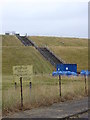
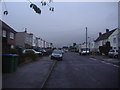
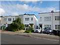
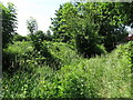
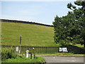
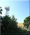
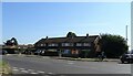
Photos of KT8 0HH


Area Information
KT8 0HH is a small residential postcode in England, home to around 1542 people. It is a compact area where daily life is shaped by its proximity to key transport links and amenities. The cluster of homes here suggests a tight-knit community, with residents likely relying on nearby services for shopping, travel, and leisure. The area’s strategic location offers easy access to major infrastructure, including Heathrow Airport and multiple rail and metro stations, which could appeal to commuters or those prioritising connectivity. While the population is modest, the presence of five retail outlets, including Sainsburys West Molesey and Tesco branches, ensures residents have access to essential shopping. The area’s low crime risk and absence of environmental constraints like protected woodlands or AONB designations make it an attractive option for those seeking a balance between convenience and tranquility. Living here means being within reach of both urban and semi-rural elements, with ferry services and parks nearby adding to its appeal.
- Area Type
- Postcode
- Area Size
- Not available
- Population
- 1542
- Population Density
- 4584 people/km²
KT8 0HH is primarily an owner-occupied area, with 74% of properties owned by residents rather than rented. This suggests a stable market where long-term residents are likely to hold onto their homes. The accommodation type is predominantly houses, which is typical for smaller, residential postcode areas. This contrasts with regions dominated by flats or apartments, offering more space and privacy. For buyers, this means the housing stock is likely to be family-friendly, with larger properties suited to those prioritising living space. The small size of the area means the immediate surroundings may also feature similar housing types, creating a cohesive local character. However, the lack of specific data on property prices or recent sales trends means potential buyers should investigate further for up-to-date market conditions.
House Prices in KT8 0HH
No properties found in this postcode.
Energy Efficiency in KT8 0HH
Living in KT8 0HH offers access to a range of amenities within practical reach. Retail options include Sainsburys West Molesey and two Tesco branches, ensuring everyday shopping needs are met. The area’s ferry services, such as Hampton Ferry Landing and Hampton Court Pier, provide scenic travel options and access to water-based activities. For transport, five rail stations—including Esher and Hersham—offer easy connections to London and surrounding areas. The proximity to Heathrow Airport, with multiple access points, is a major draw for those requiring frequent travel. A bus station at Heathrow Central adds to the area’s transport diversity. These amenities create a lifestyle that balances convenience with access to both urban and semi-rural environments, supporting a variety of daily needs and interests.
Amenities
Schools
| Rank | School | Type | Entry gender | Ages |
|---|
Explore more schools in this area
Go to Schools tabDemographics
The population of KT8 0HH skews towards adults aged 30–64, with a median age of 47. This suggests a community of established professionals and families, rather than a student or younger demographic. Home ownership is high, at 74%, indicating a stable, long-term resident base. The area is predominantly composed of houses, which aligns with the typical housing stock in smaller residential clusters. The predominant ethnic group is White, reflecting broader regional trends. While the data does not specify deprivation levels, the combination of high home ownership and low crime risk implies a relatively affluent and secure environment. The absence of detailed diversity statistics means the community’s cultural makeup remains less defined, but the presence of multiple retail and transport options suggests a functional, service-oriented lifestyle for residents.
Household Size
Accommodation Type
Tenure
Ethnic Group
Religion
Household Composition
Age
Household Deprivation
NS-SEC
Explore more demographic insights in this area
Go to Demographics tabPlanning
Planning Constraints
- Flood RiskPremium
- Ramsar Wetland SitesPremium
- Area of Outstanding Natural BeautyPremium
- Protected Nature ReservePremium
- Protected WoodlandPremium