Area Overview for KT7 0UN
Photos of KT7 0UN
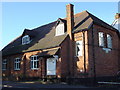
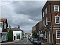
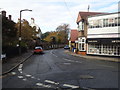
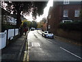

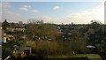
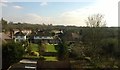
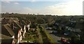
83 photos from this area
Area Information
Key information about the KT7 0UN including its size, population, and administrative classification.
- Area Type
- Postcode
- Area Size
- 8233 m²
- Population
- 1585
- Population Density
- 4239 people/km²
House Prices in KT7 0UN
11
Properties
£745,875
Average Sold Price
£180,000
Lowest Price
£1,431,000
Highest Price
Showing 11 properties
| Address | Type | Beds | Baths | Last Sale Price | Last Sale Date | |
|---|---|---|---|---|---|---|
| Thames Lodge, 129 Thorkhill Road, Thames Ditton, KT7 0UN | Semi-detached | 6 | 4 | £1,431,000 | Sep 2020 | |
| 141 Thorkhill Road, Thames Ditton, KT7 0UN | Detached | 3 | 1 | £610,000 | Nov 2015 | |
| 153 Thorkhill Road, Thames Ditton, KT7 0UN | Detached | 4 | 3 | £762,500 | Jun 2006 | |
| 130 Thorkhill Road, Thames Ditton, KT7 0UN | Semi-detached | - | - | £180,000 | Apr 2003 | |
| 155 Thorkhill Road, Thames Ditton, KT7 0UN | Detached | 5 | 2 | - | - | |
| 151 Thorkhill Road, Thames Ditton, KT7 0UN | Semi-detached | 5 | - | - | - | |
| 145 Thorkhill Road, Thames Ditton, KT7 0UN | Detached | 5 | 3 | - | - | |
| 134 Thorkhill Road, Thames Ditton, KT7 0UN | house | 4 | - | - | - | |
| 131 Thorkhill Road, Thames Ditton, KT7 0UN | house | - | - | - | - | |
| 132 Thorkhill Road, Thames Ditton, KT7 0UN | house | - | - | - | - |
Page 1 of 2
Energy Efficiency in KT7 0UN
Amenities
Schools
| Rank | School | Type | Entry gender | Ages |
|---|
Explore more schools in this area
Go to Schools tabDemographics
Household Size
Family (3-5 people)
most common
Accommodation Type
Houses
most common
Tenure
84
majority
Ethnic Group
White
most common
Religion
N/A
most common
Household Composition
N/A
most common
Age
47
median
Adults (30-64 years)
most common
Household Deprivation
N/A
with no deprivation
NS-SEC
57
in Lower managerial occupations
Explore more demographic insights in this area
Go to Demographics tabPlanning
Planning Constraints
- Flood RiskPremium
- Ramsar Wetland SitesPremium
- Area of Outstanding Natural BeautyPremium
- Protected Nature ReservePremium
- Protected WoodlandPremium