Area Overview for KT24 6RW
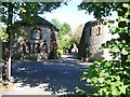
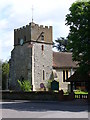
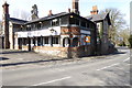
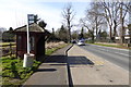
Photos of KT24 6RW

Area Information
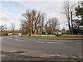
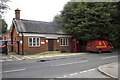
KT24 6RW is a small, tightly knit residential postcode in England, covering 2,370 square metres and home to 1,446 residents. Its compact size means it feels more like a close-knit village than a sprawling suburb, with a population density of 1,327 people per square kilometre. This area is defined by its proximity to key transport links, including multiple railway stations within reach, and a mix of local amenities that cater to daily needs. The community here is predominantly composed of adults aged 30–64, with a median age of 47, suggesting a stable, mature demographic. Living in KT24 6RW offers a blend of convenience and tranquillity, with homes primarily in private ownership and a strong sense of local identity. The area’s low flood risk and below-average crime rates contribute to a secure environment, while its digital connectivity supports modern lifestyles. Whether you’re commuting or seeking a quieter base, this postcode provides a functional, well-served living space with a distinct character shaped by its residents and geography.
- Area Type
- Postcode
- Area Size
- 2370 m²
- Population
- 1446
- Population Density
- 1327 people/km²
KT24 6RW is a predominantly owner-occupied area, with 71% of residents living in homes they own. The housing stock here is largely composed of houses, which is unusual for a small postcode but suggests a focus on family-sized properties and private ownership. This contrasts with areas dominated by rental properties or high-density housing. The small area size of 2,370 square metres means the property market is limited to a compact cluster, with limited scope for new developments or expansion. Buyers should consider that the market is likely to be competitive, with homes in demand due to the area’s safety, transport links, and proximity to amenities. The predominance of houses also implies a preference for traditional, spacious living over apartments or flats. For those seeking a home in KT24 6RW, the focus should be on securing a property in private ownership, as the rental market is not explicitly highlighted in the data. The compact nature of the area means buyers must act swiftly, as inventory is likely to be limited.
House Prices in KT24 6RW
No properties found in this postcode.
Energy Efficiency in KT24 6RW
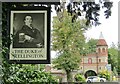
Living in KT24 6RW offers access to a range of local amenities within practical reach. The area is served by five retail outlets, including notable stores such as Waitrose Little, Sainsburys East, and Co-op High, providing everyday shopping needs. For transport, residents have five nearby railway stations—Horsley, Effingham Junction, and Bookham—offering convenient connections to regional hubs. While the data does not specify parks or leisure facilities, the proximity to rail links and retail options suggests a lifestyle balanced between convenience and accessibility. The presence of multiple shops and supermarkets indicates a focus on self-sufficiency, reducing the need for long commutes to larger centres. The area’s compact size means amenities are closely clustered, fostering a sense of community. For those who enjoy local dining or retail therapy, the named stores and stations provide a foundation for daily routines. The combination of retail and transport options ensures residents can manage both household needs and travel efficiently, supporting a practical, well-served lifestyle.
Amenities
Schools
| Rank | School | Type | Entry gender | Ages |
|---|
Explore more schools in this area
Go to Schools tabDemographics
The population of KT24 6RW is predominantly adults, with 71% of residents owning their homes. This high home ownership rate suggests a stable community with long-term residents. The median age of 47 indicates a mature demographic, with the most common age range being 30–64 years. The area is largely composed of houses, reflecting a traditional housing stock. The predominant ethnic group is White, though no specific data on diversity or deprivation levels is provided. The low population density of 1,327 people per square kilometre suggests a mix of single-family homes and smaller residential clusters. This profile points to a community focused on established living rather than transient populations, with residents likely prioritising security, familiarity, and local amenities over rapid change or high-density development. The absence of specific data on deprivation means the quality of life here can be inferred from the low crime risk and safety score of 85/100, which aligns with a relatively affluent or stable neighbourhood.
Household Size
Accommodation Type
Tenure
Ethnic Group
Religion
Household Composition
Age
Household Deprivation
NS-SEC
Explore more demographic insights in this area
Go to Demographics tabPlanning
Planning Constraints
- Flood RiskPremium
- Ramsar Wetland SitesPremium
- Area of Outstanding Natural BeautyPremium
- Protected Nature ReservePremium
- Protected WoodlandPremium