Area Overview for KT24 6SU
Photos of KT24 6SU
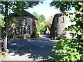
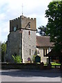
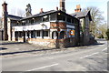
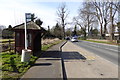
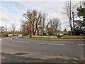
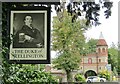
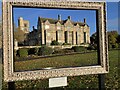
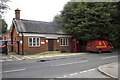
99 photos from this area
Area Information
Key information about the KT24 6SU including its size, population, and administrative classification.
- Area Type
- Postcode
- Area Size
- 2.8 hectares
- Population
- 1446
- Population Density
- 1327 people/km²
House Prices in KT24 6SU
28
Properties
£305,869
Average Sold Price
£205,000
Lowest Price
£495,000
Highest Price
Showing 28 properties
| Address | Type | Beds | Baths | Last Sale Price | Last Sale Date | |
|---|---|---|---|---|---|---|
| 46 St Martins Close, East Horsley, KT24 6SU | Semi-detached | 4 | 1 | £495,000 | Jun 2022 | |
| 50 St Martins Close, East Horsley, KT24 6SU | Maisonette | 2 | 1 | £280,000 | Mar 2019 | |
| 34 St Martins Close, East Horsley, KT24 6SU | Terraced | 3 | - | £349,950 | Apr 2015 | |
| 44 St Martins Close, East Horsley, KT24 6SU | Semi-detached | 4 | 1 | £350,000 | Sep 2013 | |
| 32 St Martins Close, East Horsley, KT24 6SU | Terraced | 3 | 1 | £252,000 | Oct 2012 | |
| 38 St Martins Close, East Horsley, KT24 6SU | Terraced | 3 | 1 | £260,000 | Apr 2012 | |
| 36 St Martins Close, East Horsley, KT24 6SU | Terraced | 3 | 1 | £255,000 | Apr 2012 | |
| 48 St Martins Close, East Horsley, KT24 6SU | Flat | - | - | £205,000 | Jul 2009 | |
| 24 St Martins Close, East Horsley, KT24 6SU | Terraced | 3 | 1 | - | - | |
| 3, Lovelace Cottages, St Martins Close, East Horsley, KT24 6SU | Terraced | 2 | 2 | - | - |
Page 1 of 3
Energy Efficiency in KT24 6SU
Amenities
Schools
| Rank | School | Type | Entry gender | Ages |
|---|
Explore more schools in this area
Go to Schools tabDemographics
Household Size
Two person
most common
Accommodation Type
Houses
most common
Tenure
71
majority
Ethnic Group
White
most common
Religion
N/A
most common
Household Composition
N/A
most common
Age
47
median
Adults (30-64 years)
most common
Household Deprivation
N/A
with no deprivation
NS-SEC
51
in Lower managerial occupations
Explore more demographic insights in this area
Go to Demographics tabPlanning
Planning Constraints
- Flood RiskPremium
- Ramsar Wetland SitesPremium
- Area of Outstanding Natural BeautyPremium
- Protected Nature ReservePremium
- Protected WoodlandPremium