Area Overview for KT22 7NY
Photos of KT22 7NY
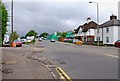
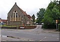
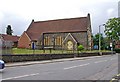
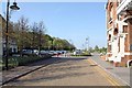


100 photos from this area
Area Information
Key information about the KT22 7NY including its size, population, and administrative classification.
- Area Type
- Postcode
- Area Size
- 1.1 hectares
- Population
- 2275
- Population Density
- 534 people/km²
House Prices in KT22 7NY
27
Properties
£341,778
Average Sold Price
£115,000
Lowest Price
£595,000
Highest Price
Showing 27 properties
| Address | Type | Beds | Baths | Last Sale Price | Last Sale Date | |
|---|---|---|---|---|---|---|
| 2 Dilston Road, Leatherhead, KT22 7NY | Semi-detached | 3 | 1 | £452,000 | Mar 2025 | |
| 13 Dilston Road, Leatherhead, KT22 7NY | Semi-detached | 4 | 2 | £595,000 | Jan 2025 | |
| 23 Dilston Road, Leatherhead, KT22 7NY | Semi-detached | 3 | 1 | £580,000 | Jun 2024 | |
| 3 Dilston Road, Leatherhead, KT22 7NY | Flat | 2 | 1 | £393,000 | Dec 2022 | |
| 12 Dilston Road, Leatherhead, KT22 7NY | house | 3 | - | £593,000 | May 2022 | |
| 10 Dilston Road, Leatherhead, KT22 7NY | Semi-detached | 3 | - | £418,000 | Oct 2019 | |
| 17 Dilston Road, Leatherhead, KT22 7NY | Semi-detached | 3 | 1 | £350,000 | Jul 2014 | |
| 1 Dilston Road, Leatherhead, KT22 7NY | Semi-detached | 5 | 3 | £395,000 | Apr 2014 | |
| 16 Dilston Road, Leatherhead, KT22 7NY | house | - | - | £220,000 | Oct 2010 | |
| 14 Dilston Road, Leatherhead, KT22 7NY | Terraced | - | - | £287,500 | Jul 2007 |
Page 1 of 3
Energy Efficiency in KT22 7NY
Amenities
Schools
| Rank | School | Type | Entry gender | Ages |
|---|
Explore more schools in this area
Go to Schools tabDemographics
Household Size
Two person
most common
Accommodation Type
Houses
most common
Tenure
65
majority
Ethnic Group
White
most common
Religion
N/A
most common
Household Composition
N/A
most common
Age
47
median
Adults (30-64 years)
most common
Household Deprivation
N/A
with no deprivation
NS-SEC
40
in Lower managerial occupations
Explore more demographic insights in this area
Go to Demographics tabPlanning
Planning Constraints
- Flood RiskPremium
- Ramsar Wetland SitesPremium
- Area of Outstanding Natural BeautyPremium
- Protected Nature ReservePremium
- Protected WoodlandPremium