Area Overview for KT22 7NE
Photos of KT22 7NE
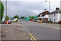
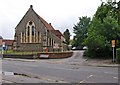
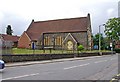
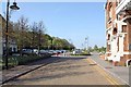

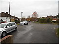
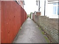


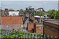
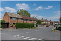

100 photos from this area
Area Information
Key information about the KT22 7NE including its size, population, and administrative classification.
- Area Type
- Postcode
- Area Size
- 1.5 hectares
- Population
- 2275
- Population Density
- 534 people/km²
House Prices in KT22 7NE
44
Properties
£290,197
Average Sold Price
£77,500
Lowest Price
£427,000
Highest Price
Showing 44 properties
| Address | Type | Beds | Baths | Last Sale Price | Last Sale Date | |
|---|---|---|---|---|---|---|
| 6 Cleeve Road, Leatherhead, KT22 7NE | house | 3 | 1 | £415,000 | Oct 2023 | |
| 78 Cleeve Road, Leatherhead, KT22 7NE | Terraced | 3 | 1 | £360,000 | Aug 2021 | |
| 32 Cleeve Road, Leatherhead, KT22 7NE | house | - | - | £427,000 | Jun 2021 | |
| 86 Cleeve Road, Leatherhead, KT22 7NE | Semi-detached | 3 | 2 | £407,000 | Aug 2019 | |
| 72 Cleeve Road, Leatherhead, KT22 7NE | house | 3 | - | £357,000 | Apr 2017 | |
| 22 Cleeve Road, Leatherhead, KT22 7NE | house | - | - | £405,000 | Dec 2016 | |
| 28 Cleeve Road, Leatherhead, KT22 7NE | Semi-detached | 3 | 1 | £347,500 | Jan 2016 | |
| 68 Cleeve Road, Leatherhead, KT22 7NE | Terraced | 3 | 1 | £310,000 | Jan 2015 | |
| 2 Cleeve Road, Leatherhead, KT22 7NE | Terraced | 1 | 1 | £250,000 | Nov 2013 | |
| 26 Cleeve Road, Leatherhead, KT22 7NE | Semi-detached | 3 | 1 | £250,000 | Sep 2013 |
Page 1 of 5
Energy Efficiency in KT22 7NE
Amenities
Schools
| Rank | School | Type | Entry gender | Ages |
|---|
Explore more schools in this area
Go to Schools tabDemographics
Household Size
Two person
most common
Accommodation Type
Houses
most common
Tenure
65
majority
Ethnic Group
White
most common
Religion
N/A
most common
Household Composition
N/A
most common
Age
47
median
Adults (30-64 years)
most common
Household Deprivation
N/A
with no deprivation
NS-SEC
40
in Lower managerial occupations
Explore more demographic insights in this area
Go to Demographics tabPlanning
Planning Constraints
- Flood RiskPremium
- Ramsar Wetland SitesPremium
- Area of Outstanding Natural BeautyPremium
- Protected Nature ReservePremium
- Protected WoodlandPremium