Area Overview for KT22 0SF
Photos of KT22 0SF
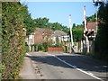

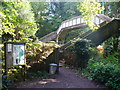
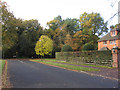
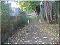
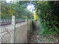

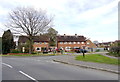
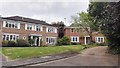

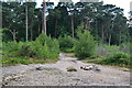
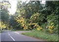
29 photos from this area
Area Information
Key information about the KT22 0SF including its size, population, and administrative classification.
- Area Type
- Postcode
- Area Size
- 1.6 hectares
- Population
- 1681
- Population Density
- 925 people/km²
House Prices in KT22 0SF
35
Properties
£350,375
Average Sold Price
£185,000
Lowest Price
£650,000
Highest Price
Showing 35 properties
| Address | Type | Beds | Baths | Last Sale Price | Last Sale Date | |
|---|---|---|---|---|---|---|
| 7 Webster Close, Oxshott, Leatherhead, KT22 0SF | Semi-detached | 3 | 1 | £650,000 | Jul 2022 | |
| 11A Webster Close, Oxshott, Leatherhead, KT22 0SF | house | - | - | £317,500 | Apr 2008 | |
| 18 Webster Close, Oxshott, Leatherhead, KT22 0SF | Maisonette | 2 | 1 | £185,000 | Feb 2007 | |
| 23 Webster Close, Oxshott, Leatherhead, KT22 0SF | Semi-detached | - | - | £249,000 | Aug 2002 | |
| 22 Webster Close, Oxshott, Leatherhead, KT22 0SF | Semi-detached | 3 | 1 | - | - | |
| 5 Webster Close, Oxshott, Leatherhead, KT22 0SF | Semi-detached | 2 | 1 | - | - | |
| 20 Webster Close, Oxshott, Leatherhead, KT22 0SF | Detached | 4 | 1 | - | - | |
| 15 Webster Close, Oxshott, Leatherhead, KT22 0SF | house | 4 | - | - | - | |
| 11 Webster Close, Oxshott, Leatherhead, KT22 0SF | house | 3 | - | - | - | |
| Plot 43, Littleheath Farm Estate, Waverley Road, Stoke Dabernon, Cobham, KT22 0SF | Flat | - | - | - | - |
Page 1 of 4
Energy Efficiency in KT22 0SF
Amenities
Schools
| Rank | School | Type | Entry gender | Ages |
|---|
Explore more schools in this area
Go to Schools tabDemographics
Household Size
Family (3-5 people)
most common
Accommodation Type
Houses
most common
Tenure
78
majority
Ethnic Group
White
most common
Religion
N/A
most common
Household Composition
N/A
most common
Age
47
median
Adults (30-64 years)
most common
Household Deprivation
N/A
with no deprivation
NS-SEC
55
in Lower managerial occupations
Explore more demographic insights in this area
Go to Demographics tabPlanning
Planning Constraints
- Flood RiskPremium
- Ramsar Wetland SitesPremium
- Area of Outstanding Natural BeautyPremium
- Protected Nature ReservePremium
- Protected WoodlandPremium