Area Overview for KT22 0HS
Photos of KT22 0HS
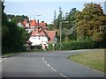
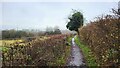
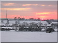


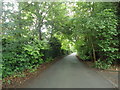
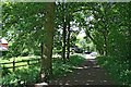
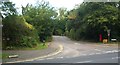
13 photos from this area
Area Information
Key information about the KT22 0HS including its size, population, and administrative classification.
- Area Type
- Postcode
- Area Size
- 11.9 hectares
- Population
- 1681
- Population Density
- 925 people/km²
House Prices in KT22 0HS
12
Properties
£1,385,688
Average Sold Price
£325,000
Lowest Price
£2,245,000
Highest Price
Showing 12 properties
| Address | Type | Beds | Baths | Last Sale Price | Last Sale Date | |
|---|---|---|---|---|---|---|
| Woodleaze, Manor Way, Oxshott, Leatherhead, KT22 0HS | house | - | - | £1,575,500 | Jun 2021 | |
| Manor Cottage, Manor Way, Oxshott, Leatherhead, KT22 0HS | Detached | 5 | - | £2,245,000 | Jun 2020 | |
| Ty R Nant, Manor Way, Oxshott, Leatherhead, KT22 0HS | house | - | - | £1,210,000 | Apr 2018 | |
| Cley Cottage, Manor Way, Oxshott, Leatherhead, KT22 0HS | Detached | 5 | 3 | £1,710,000 | Jul 2015 | |
| Springwell House, Manor Way, Oxshott, Leatherhead, KT22 0HS | Detached | 6 | - | £1,695,000 | Jun 2008 | |
| Field House, Manor Way, Oxshott, Leatherhead, KT22 0HS | Detached | - | - | £1,800,000 | Mar 2002 | |
| Richlin, Manor Way, Oxshott, Leatherhead, KT22 0HS | Detached | - | - | £525,000 | Oct 1998 | |
| Saffrons, Manor Way, Oxshott, Leatherhead, KT22 0HS | Detached | 5 | 3 | £325,000 | Nov 1997 | |
| Clavis, Manor Way, Oxshott, Leatherhead, KT22 0HS | Detached | 6 | 3 | - | - | |
| Doles Ash, Manor Way, Oxshott, Leatherhead, KT22 0HS | Detached | 4 | - | - | - |
Page 1 of 2
Energy Efficiency in KT22 0HS
Amenities
Schools
| Rank | School | Type | Entry gender | Ages |
|---|
Explore more schools in this area
Go to Schools tabDemographics
Household Size
Family (3-5 people)
most common
Accommodation Type
Houses
most common
Tenure
78
majority
Ethnic Group
White
most common
Religion
N/A
most common
Household Composition
N/A
most common
Age
47
median
Adults (30-64 years)
most common
Household Deprivation
N/A
with no deprivation
NS-SEC
55
in Lower managerial occupations
Explore more demographic insights in this area
Go to Demographics tabPlanning
Planning Constraints
- Flood RiskPremium
- Ramsar Wetland SitesPremium
- Area of Outstanding Natural BeautyPremium
- Protected Nature ReservePremium
- Protected WoodlandPremium