Area Overview for KT22 0BN
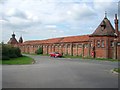
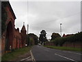
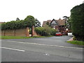
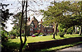
Photos of KT22 0BN
Area Information
Living in KT22 0BN offers a compact, residential experience within a 9.7-hectare area. The postcode covers a small cluster of homes, home to 1,821 residents, with a population density of 507 people per square kilometre. This is a community of largely established adults, with a median age of 47 and most residents aged 30–64. The area is predominantly owner-occupied, with 79% of homes owned by their occupants, and houses make up the majority of accommodation types. Daily life here is shaped by proximity to key amenities: nearby retail options include Tesco Leatherhead and Sainsburys Fetcham, while rail access to Oxshott and Leatherhead stations provides easy links to larger towns. The area’s low crime risk score of 81 and absence of flood or environmental constraints make it a stable, low-stress environment. However, the presence of protected woodland nearby adds a layer of natural interest, though it may influence planning decisions. For those seeking a quiet, well-connected residential area with minimal risk factors, KT22 0BN offers a straightforward, practical living option.
- Area Type
- Postcode
- Area Size
- 9.7 hectares
- Population
- 1821
- Population Density
- 507 people/km²
The property market in KT22 0BN is characterised by a strong emphasis on owner-occupation, with 79% of homes owned by their residents. This suggests a market where long-term residency is common, and property values may be relatively stable. The area is predominantly composed of houses, which contrasts with regions where flats or apartments dominate. For buyers, this means a focus on single-family homes rather than rental properties, though the small size of the postcode (9.7 hectares) limits the availability of new builds or developments. The lack of planning constraints such as AONB or Ramsar sites may make the area more attractive for those seeking straightforward property transactions. However, the presence of protected woodland nearby could influence future development potential. Buyers should consider the compact nature of the area, which may mean limited options for expansion or renovation. Overall, KT22 0BN is a niche market suited to those prioritising security, simplicity, and proximity to essential services.
House Prices in KT22 0BN
Showing 5 properties
| Address | Type | Beds | Baths | Last Sale Price | Last Sale Date | |
|---|---|---|---|---|---|---|
| Staff Flat, Qetc Leatherhead Court, Woodlands Road, Leatherhead, KT22 0BN | Semi-detached | 3 | 3 | - | - | |
| Qetc Leatherhead Court, Woodlands Road, Leatherhead, KT22 0BN | hospital_care_home | - | - | - | - | |
| Male Residents Block G.b.s.e. House E, Qetc Leatherhead Court, Woodlands Road, Leatherhead, KT22 0BN | Flat | - | - | - | - | |
| Female Residents Block, Qetc Leatherhead Court, Woodlands Road, Leatherhead, KT22 0BN | Flat | - | - | - | - | |
| Staff Accommodation, Qetc Leatherhead Court, Woodlands Road, Leatherhead, KT22 0BN | Flat | - | - | - | - |
Energy Efficiency in KT22 0BN
The lifestyle in KT22 0BN is shaped by its proximity to a range of amenities. Retail options include major supermarkets such as Tesco Leatherhead, Sainsburys Fetcham, and Morrisons Daily, ensuring easy access to groceries and everyday essentials. Rail stations like Oxshott and Leatherhead provide connections to broader transport networks, while ferry services at Ditton Island and Hampton Court Pier add recreational and commuter options. Though the area is small, the combination of retail, transport, and water access creates a convenient daily life. The presence of protected woodland nearby may offer opportunities for walking or nature-related activities, though specific parks or leisure facilities are not detailed in the data. Overall, residents enjoy a mix of practical necessities and transport flexibility, making KT22 0BN a functional choice for those valuing accessibility over expansive leisure options.
Amenities
Schools
The nearest school to KT22 0BN is Parkside School, an independent institution. Independent schools typically offer smaller class sizes, specialist facilities, and a focus on academic or extracurricular excellence. While no Ofsted rating is provided, the presence of a single independent school suggests a community where families may prioritise private education. This contrasts with areas offering a mix of state and independent schools, which can provide broader options. For families seeking a school with a distinct educational approach, Parkside School is the primary option nearby. However, the absence of other schools in the data means that parents may need to look beyond the immediate area for additional choices. The school’s type and the lack of nearby alternatives should be considered when evaluating the area’s suitability for households with children.
| Rank | School | Type | Entry gender | Ages |
|---|
Explore more schools in this area
Go to Schools tabDemographics
The community in KT22 0BN is defined by its mature age profile, with a median age of 47 and the majority of residents falling within the 30–64 age range. This suggests a population of largely established professionals and families, with fewer young children or retirees. Home ownership is high, at 79%, indicating a stable, long-term resident base. The area is dominated by houses rather than flats, reflecting a preference for single-family living. The predominant ethnic group is White, which aligns with broader demographic trends in the region. The population density of 507 people per square kilometre is moderate, balancing residential space with community proximity. While no specific deprivation data is provided, the high home ownership rate and low crime risk suggest a relatively affluent and secure environment. This profile positions KT22 0BN as a place where stability and practicality take precedence over rapid change or diversity of lifestyles.
Household Size
Accommodation Type
Tenure
Ethnic Group
Religion
Household Composition
Age
Household Deprivation
NS-SEC
Explore more demographic insights in this area
Go to Demographics tabPlanning
Planning Constraints
- Flood RiskPremium
- Ramsar Wetland SitesPremium
- Area of Outstanding Natural BeautyPremium
- Protected Nature ReservePremium
- Protected WoodlandPremium