Area Overview for KT21 2SG
Photos of KT21 2SG
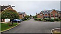
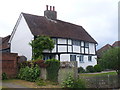
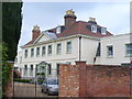
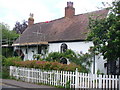
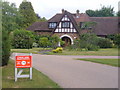
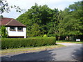
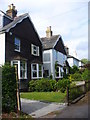
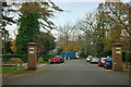
15 photos from this area
Area Information
Key information about the KT21 2SG including its size, population, and administrative classification.
- Area Type
- Postcode
- Area Size
- 3.3 hectares
- Population
- 1444
- Population Density
- 385 people/km²
House Prices in KT21 2SG
13
Properties
£2,482,143
Average Sold Price
£500,000
Lowest Price
£3,950,000
Highest Price
Showing 13 properties
| Address | Type | Beds | Baths | Last Sale Price | Last Sale Date | |
|---|---|---|---|---|---|---|
| Timberchase, The Warren, Ashtead, KT21 2SG | Bungalow | 4 | 2 | £1,725,000 | Nov 2025 | |
| Ryemead, The Warren, Ashtead, KT21 2SG | Detached | 6 | 6 | £3,800,000 | Jun 2021 | |
| Whyteside, The Warren, Ashtead, KT21 2SG | Detached | 6 | 6 | £3,400,000 | Mar 2021 | |
| Longbourne, The Warren, Ashtead, KT21 2SG | house | - | - | £500,000 | Mar 2021 | |
| Inveroran, The Warren, Ashtead, KT21 2SG | Bungalow | - | - | £1,250,000 | Dec 2019 | |
| Pinebrook, The Warren, Ashtead, KT21 2SG | house | - | - | £2,750,000 | Sep 2016 | |
| High Warren, The Warren, Ashtead, KT21 2SG | Detached | 6 | 6 | £3,950,000 | Dec 2015 | |
| Willow Green (demol), The Warren, Ashtead, KT21 2SG | undefined | 4 | - | - | - | |
| Homeside (demol), The Warren, Ashtead, KT21 2SG | undefined | - | - | - | - | |
| High Warren (demol), The Warren, Ashtead, KT21 2SG | undefined | - | - | - | - |
Page 1 of 2
Energy Efficiency in KT21 2SG
Amenities
Schools
| Rank | School | Type | Entry gender | Ages |
|---|
Explore more schools in this area
Go to Schools tabDemographics
Household Size
Family (3-5 people)
most common
Accommodation Type
Houses
most common
Tenure
90
majority
Ethnic Group
White
most common
Religion
N/A
most common
Household Composition
N/A
most common
Age
47
median
Adults (30-64 years)
most common
Household Deprivation
N/A
with no deprivation
NS-SEC
56
in Lower managerial occupations
Explore more demographic insights in this area
Go to Demographics tabPlanning
Planning Constraints
- Flood RiskPremium
- Ramsar Wetland SitesPremium
- Area of Outstanding Natural BeautyPremium
- Protected Nature ReservePremium
- Protected WoodlandPremium