Area Overview for KT21 2UD
Photos of KT21 2UD
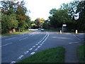
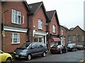
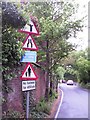
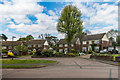
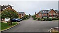
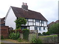
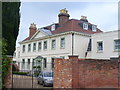
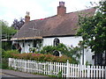
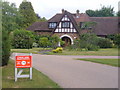
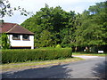
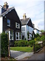
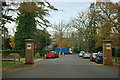
15 photos from this area
Area Information
Key information about the KT21 2UD including its size, population, and administrative classification.
- Area Type
- Postcode
- Area Size
- 2.3 hectares
- Population
- 1444
- Population Density
- 385 people/km²
House Prices in KT21 2UD
12
Properties
£954,286
Average Sold Price
£450,000
Lowest Price
£1,315,000
Highest Price
Showing 12 properties
| Address | Type | Beds | Baths | Last Sale Price | Last Sale Date | |
|---|---|---|---|---|---|---|
| Mayfield, Crampshaw Lane, Ashtead, KT21 2UD | Detached | 4 | 2 | £1,130,000 | Apr 2018 | |
| Thirty Trees, Crampshaw Lane, Ashtead, KT21 2UD | Detached | 6 | - | £1,315,000 | Dec 2014 | |
| Elm Tree House, Crampshaw Lane, Ashtead, KT21 2UD | Detached | 6 | - | £1,250,000 | Aug 2014 | |
| Hawthorne Cottage, Crampshaw Lane, Ashtead, KT21 2UD | Detached | 4 | 2 | £1,300,000 | Nov 2013 | |
| Pine Lodge, Crampshaw Lane, Ashtead, KT21 2UD | Detached | - | - | £765,000 | Aug 2006 | |
| April Cottage, Crampshaw Lane, Ashtead, KT21 2UD | Semi-detached | - | - | £450,000 | Jul 1999 | |
| Old Acres, Crampshaw Lane, Ashtead, KT21 2UD | Detached | - | - | £470,000 | Apr 1998 | |
| Coombe End, Crampshaw Lane, Ashtead, KT21 2UD | Detached | - | - | - | - | |
| Palengrove, Crampshaw Lane, Ashtead, KT21 2UD | Unknown | - | - | - | - | |
| The Willows, Crampshaw Lane, Ashtead, KT21 2UD | Detached | - | - | - | - |
Page 1 of 2
Energy Efficiency in KT21 2UD
Amenities
Schools
| Rank | School | Type | Entry gender | Ages |
|---|
Explore more schools in this area
Go to Schools tabDemographics
Household Size
Family (3-5 people)
most common
Accommodation Type
Houses
most common
Tenure
90
majority
Ethnic Group
White
most common
Religion
N/A
most common
Household Composition
N/A
most common
Age
47
median
Adults (30-64 years)
most common
Household Deprivation
N/A
with no deprivation
NS-SEC
56
in Lower managerial occupations
Explore more demographic insights in this area
Go to Demographics tabPlanning
Planning Constraints
- Flood RiskPremium
- Ramsar Wetland SitesPremium
- Area of Outstanding Natural BeautyPremium
- Protected Nature ReservePremium
- Protected WoodlandPremium