Area Overview for KT20 6PZ
Photos of KT20 6PZ
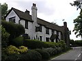
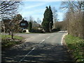
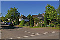
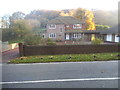
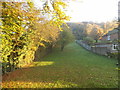
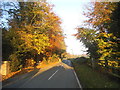
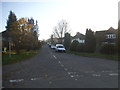
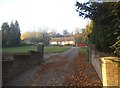
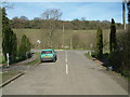
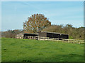
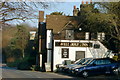
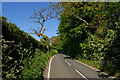
15 photos from this area
Area Information
Key information about the KT20 6PZ including its size, population, and administrative classification.
- Area Type
- Postcode
- Area Size
- 6.6 hectares
- Population
- 1793
- Population Density
- 675 people/km²
House Prices in KT20 6PZ
22
Properties
£1,802,692
Average Sold Price
£405,000
Lowest Price
£3,550,000
Highest Price
Showing 22 properties
| Address | Type | Beds | Baths | Last Sale Price | Last Sale Date | |
|---|---|---|---|---|---|---|
| Red Chimneys, Warren Drive, Kingswood, KT20 6PZ | Land | 7 | 6 | £2,500,000 | Jan 2023 | |
| Brackenside, Warren Drive, Kingswood, KT20 6PZ | Detached | 6 | 6 | £3,550,000 | Jan 2022 | |
| Aspen, Warren Drive, Kingswood, KT20 6PZ | Detached | 6 | 6 | £2,350,000 | Apr 2018 | |
| Wisteria House, Warren Drive, Kingswood, KT20 6PZ | Detached | 5 | 6 | £1,680,000 | Feb 2018 | |
| Breckenridge, Warren Drive, Kingswood, KT20 6PZ | Detached | 5 | 6 | £2,500,000 | Mar 2017 | |
| Brandelhow, Warren Drive, Kingswood, KT20 6PZ | Detached | - | - | £1,265,000 | Jan 2017 | |
| Davos House, Warren Drive, Kingswood, KT20 6PZ | Detached | 6 | 5 | £3,300,000 | Mar 2016 | |
| Edenfield, Warren Drive, Kingswood, KT20 6PZ | house | - | - | £1,950,000 | Sep 2012 | |
| Albury Lodge, Warren Drive, Kingswood, KT20 6PZ | Detached | 5 | 4 | £1,400,000 | Aug 2010 | |
| Birchwood, Warren Drive, Kingswood, KT20 6PZ | Detached | - | - | £1,300,000 | Feb 2008 |
Page 1 of 3
Energy Efficiency in KT20 6PZ
Amenities
Schools
| Rank | School | Type | Entry gender | Ages |
|---|
Explore more schools in this area
Go to Schools tabDemographics
Household Size
Family (3-5 people)
most common
Accommodation Type
Houses
most common
Tenure
90
majority
Ethnic Group
White
most common
Religion
N/A
most common
Household Composition
N/A
most common
Age
47
median
Adults (30-64 years)
most common
Household Deprivation
N/A
with no deprivation
NS-SEC
55
in Lower managerial occupations
Explore more demographic insights in this area
Go to Demographics tabPlanning
Planning Constraints
- Flood RiskPremium
- Ramsar Wetland SitesPremium
- Area of Outstanding Natural BeautyPremium
- Protected Nature ReservePremium
- Protected WoodlandPremium