Area Overview for KT20 6NE
Photos of KT20 6NE
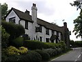
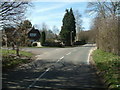
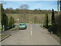
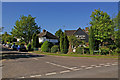
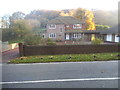
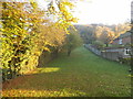
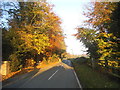

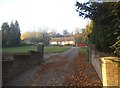
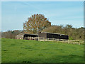
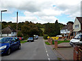
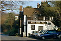
15 photos from this area
Area Information
Key information about the KT20 6NE including its size, population, and administrative classification.
- Area Type
- Postcode
- Area Size
- 17.8 hectares
- Population
- 1716
- Population Density
- 828 people/km²
House Prices in KT20 6NE
23
Properties
£1,570,500
Average Sold Price
£650,000
Lowest Price
£2,850,000
Highest Price
Showing 23 properties
| Address | Type | Beds | Baths | Last Sale Price | Last Sale Date | |
|---|---|---|---|---|---|---|
| Orchard End, Sandy Lane, Kingswood, KT20 6NE | Detached | 6 | 5 | £2,100,000 | Feb 2021 | |
| Apes Hill, Sandy Lane, Kingswood, KT20 6NE | house | 5 | - | £2,000,000 | Dec 2019 | |
| Warren Farm House, Sandy Lane, Kingswood, KT20 6NE | Detached | 4 | 4 | £1,425,000 | Nov 2019 | |
| Gleneagles, Sandy Lane, Kingswood, KT20 6NE | Detached | 4 | 6 | £2,850,000 | Aug 2019 | |
| Turnberry, Sandy Lane, Kingswood, KT20 6NE | Detached | 5 | 6 | £2,720,000 | Apr 2016 | |
| Wood Hay, Sandy Lane, Kingswood, KT20 6NE | Bungalow | - | - | £955,000 | Mar 2016 | |
| Apple Trees, Sandy Lane, Kingswood, KT20 6NE | house | - | - | £1,290,000 | Jun 2015 | |
| Longford Place, Sandy Lane, Kingswood, KT20 6NE | Detached | 3 | 1 | £825,000 | Jun 2014 | |
| Tamarisk, Sandy Lane, Kingswood, KT20 6NE | Detached | 4 | 5 | £650,000 | May 2011 | |
| Hollyhurst, Sandy Lane, Kingswood, KT20 6NE | Detached | - | - | £890,000 | Sep 2005 |
Page 1 of 3
Energy Efficiency in KT20 6NE
Amenities
Schools
| Rank | School | Type | Entry gender | Ages |
|---|
Explore more schools in this area
Go to Schools tabDemographics
Household Size
Family (3-5 people)
most common
Accommodation Type
Houses
most common
Tenure
85
majority
Ethnic Group
White
most common
Religion
N/A
most common
Household Composition
N/A
most common
Age
47
median
Adults (30-64 years)
most common
Household Deprivation
N/A
with no deprivation
NS-SEC
37
in Lower managerial occupations
Explore more demographic insights in this area
Go to Demographics tabPlanning
Planning Constraints
- Flood RiskPremium
- Ramsar Wetland SitesPremium
- Area of Outstanding Natural BeautyPremium
- Protected Nature ReservePremium
- Protected WoodlandPremium