Area Overview for KT19 9AU
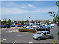
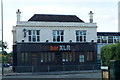
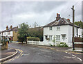
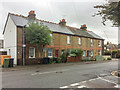
Photos of KT19 9AU


Area Information
KT19 9AU is a small, densely populated residential postcode in England, covering 2,783 square metres and home to 1,764 residents. Its compact size means it feels like a tight-knit community, though the population density of 633,783 people per square kilometre reflects its intensity. The area is defined by its proximity to multiple transport hubs, including Ewell West and Epsom railway stations, and its mix of retail and leisure options. With a median age of 47, the population skews toward adults aged 30–64, suggesting a stable, mature demographic. Daily life here balances practicality with accessibility: residents can reach shops like Sainsburys Kiln and Co-op Chessington within minutes, while rail links provide easy access to nearby towns. The area’s small footprint means it’s not suited for sprawling development, but its proximity to amenities and transport networks makes it appealing for those prioritising convenience over space. For buyers, KT19 9AU offers a snapshot of suburban living with a focus on connectivity and community.
- Area Type
- Postcode
- Area Size
- 2783 m²
- Population
- 1764
- Population Density
- 4307 people/km²
KT19 9AU is a small area with a housing stock primarily composed of houses, reflecting a preference for detached or semi-detached properties over flats or apartments. With 42% of homes owner-occupied, the market is a blend of private ownership and rental properties, though the exact proportion of rental stock is not specified. The area’s limited size means property availability is constrained, which could drive competition among buyers. For those seeking a house, the focus on single-family homes may appeal to families or professionals prioritising space and privacy. However, the small footprint of KT19 9AU means buyers should consider nearby areas for more options. The predominance of houses also suggests a quieter, less dense environment compared to urban centres. Potential buyers should note that the area’s compact nature may limit scope for development, making it a niche market for those valuing established, low-rise housing.
House Prices in KT19 9AU
No properties found in this postcode.
Energy Efficiency in KT19 9AU
Living in KT19 9AU offers access to a range of amenities within practical reach. Retail options include Sainsburys Kiln, Co-op Chessington, and Tesco Ewell, ensuring everyday shopping needs are met. The area’s transport links connect residents to leisure and cultural hubs: Epsom railway station provides access to nearby attractions, while ferry landings like Kingston Turks Pier offer waterfront activities. For commuters, the density of rail and metro stops — including Ewell East and Belgrave Walk Tram Stop — ensures frequent service to London and surrounding areas. The presence of multiple retail and transport nodes suggests a convenient, functional lifestyle, though the area’s small size means it lacks large-scale leisure facilities. Residents can enjoy a mix of practicality and accessibility, with shops, transport, and water-based connectivity all within short distances. This balance of convenience and connectivity makes KT19 9AU suitable for those prioritising efficiency over sprawling suburban expanses.
Amenities
Schools
| Rank | School | Type | Entry gender | Ages |
|---|
Explore more schools in this area
Go to Schools tabDemographics
The community in KT19 9AU is predominantly composed of adults aged 30–64, with a median age of 47. This suggests a population focused on established careers and family life, rather than younger or retired residents. Home ownership rates stand at 42%, meaning nearly half of properties are rented, which may reflect the area’s appeal to professionals or commuters seeking flexibility. The accommodation type is primarily houses, which contrasts with higher-density housing in other parts of the UK. The predominant ethnic group is White, though no specific data on diversity or deprivation levels is provided. The age profile indicates a stable, middle-aged population, which may influence local services and amenities. With 1,764 residents in a small area, social interactions are likely frequent, but the high population density could impact living space per person. This demographic profile suggests a community that values stability, practicality, and proximity to transport and retail.
Household Size
Accommodation Type
Tenure
Ethnic Group
Religion
Household Composition
Age
Household Deprivation
NS-SEC
Explore more demographic insights in this area
Go to Demographics tabPlanning
Planning Constraints
- Flood RiskPremium
- Ramsar Wetland SitesPremium
- Area of Outstanding Natural BeautyPremium
- Protected Nature ReservePremium
- Protected WoodlandPremium