Area Overview for KT19 9SX
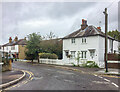
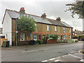
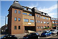
Photos of KT19 9SX


Area Information
KT19 9SX is a small, tightly knit residential postcode area in England, home to 1,764 residents. It is a compact cluster of homes, predominantly houses, catering to a community of adults aged 30–64, with a median age of 47. The area’s modest size means it is not a sprawling suburb but a focused neighbourhood where daily life is shaped by proximity to local amenities and transport links. Residents benefit from excellent broadband connectivity, rated 100 out of 100, ensuring seamless online activity. While the area has no protected natural sites or flood risks, it is not without challenges: crime rates sit at an average level, requiring standard security measures. KT19 9SX is ideal for those seeking a quieter, community-oriented lifestyle with access to nearby retail, rail, and ferry services. Its small footprint means it is not a high-density area, but its strategic location near Epsom and Ewell offers convenience without urban congestion. Living here feels like a balance between rural tranquillity and practical connectivity, with homes primarily owner-occupied and a strong local identity.
- Area Type
- Postcode
- Area Size
- Not available
- Population
- 1764
- Population Density
- 4307 people/km²
KT19 9SX is a small area with a limited housing stock, primarily consisting of houses rather than apartments or flats. With 42% of residents owning their homes, it is not a high-rental market but rather one where property ownership is more common. The predominance of houses suggests a focus on family homes or larger properties, which may appeal to those seeking space and privacy. However, the area’s size means the property market is not expansive, and buyers may need to look beyond the immediate postcode for more options. The owner-occupied nature of the area implies a stable market, but with limited supply, competition for homes could be keen. For those considering KT19 9SX, it is important to view it as part of a broader regional market, particularly in nearby Epsom and Ewell, where additional properties may be available. The lack of high-density housing also means the area is not suited to those prioritising urban living or rental investments.
House Prices in KT19 9SX
No properties found in this postcode.
Energy Efficiency in KT19 9SX
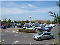
KT19 9SX offers a mix of retail, transport, and leisure options within easy reach. Local shops include Sainsburys Kiln, Co-op Chessington, and Co-op Epsom, providing everyday essentials. The area’s rail network is extensive, with stations like Ewell West and Epsom offering regular services to London and Surrey. Ferry landings such as Ditton Island and Kingston Town End Pier add a touch of waterfront access, though they are more for leisure than commuting. Metro and tram stops, including Mitcham Tram Stop, connect residents to broader transport networks. The presence of multiple retail and transport hubs suggests a convenient, if modest, lifestyle. While not a hub for nightlife or large-scale entertainment, the area’s proximity to Epsom and Ewell means residents can access larger amenities nearby. The combination of practical retail, reliable transport, and quiet living makes KT19 9SX appealing to those valuing accessibility without urban density.
Amenities
Schools
| Rank | School | Type | Entry gender | Ages |
|---|
Explore more schools in this area
Go to Schools tabDemographics
The population of KT19 9SX is characterised by a median age of 47, with the majority of residents falling within the 30–64 age range. This suggests a mature, stable community with a focus on established households. Home ownership rates stand at 42%, meaning nearly half of residents own their homes, while the remainder are likely to be renting. The area is predominantly composed of houses, which aligns with the demographic profile of older, settled adults. The predominant ethnic group is White, reflecting a homogenous community. While no specific data on deprivation is provided, the absence of protected natural areas or flood risks indicates a relatively low environmental risk profile. However, the crime risk score of 50/100 suggests that while not exceptional, residents should remain vigilant. The demographic composition implies a community with a strong local presence, where daily life is shaped by routine and familiarity rather than rapid change.
Household Size
Accommodation Type
Tenure
Ethnic Group
Religion
Household Composition
Age
Household Deprivation
NS-SEC
Explore more demographic insights in this area
Go to Demographics tabPlanning
Planning Constraints
- Flood RiskPremium
- Ramsar Wetland SitesPremium
- Area of Outstanding Natural BeautyPremium
- Protected Nature ReservePremium
- Protected WoodlandPremium