Area Overview for KT19 8QG
Photos of KT19 8QG


Area Information
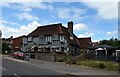
KT19 8QG is a small residential cluster in England, spanning 34.1 hectares and home to 2,527 residents. The area’s compact size and high population density of 1,374 people per square kilometre suggest a tightly knit community. Daily life here is shaped by its proximity to local amenities and transport links. With 85% of homes owned by residents, the area leans toward long-term occupancy rather than rental turnover. The median age of 47 indicates a mature demographic, with adults aged 30–64 forming the majority. This suggests a stable population, likely with established careers and families. While the area lacks natural beauty designations or protected land, its safety profile is strong, with a crime risk score of 80. Residents benefit from excellent broadband connectivity, scoring 96, and practical access to rail, ferry, and metro services. KT19 8QG is ideal for those seeking a quiet, secure environment with good infrastructure, though its small size means limited space for expansion.
- Area Type
- Postcode
- Area Size
- 34.1 hectares
- Population
- 2527
- Population Density
- 1374 people/km²
KT19 8QG is primarily an owner-occupied area, with 85% of homes owned by residents rather than rented. This suggests a stable property market with limited turnover, appealing to buyers seeking long-term investment. The accommodation type is predominantly houses, which is uncommon in densely populated areas, indicating a low-rise, family-friendly layout. The small size of the area—just 34.1 hectares—means the housing stock is limited, and buyers should consider proximity to nearby towns for additional options. The high home ownership rate implies strong local demand, potentially leading to competitive pricing. For those prioritising privacy and space, this area offers a traditional housing model, though its compact size may restrict availability for larger families or those seeking multiple properties.
House Prices in KT19 8QG
No properties found in this postcode.
Energy Efficiency in KT19 8QG
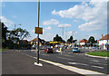
Living in KT19 8QG offers access to a range of amenities within practical reach. Retail options include Tesco Ruxley, The Southern Co-operative Co, and Tesco Epsom, providing everyday shopping convenience. For transport, residents can use Ewell West Railway Station, Chessington North Station, and Morden Road Tram Stop, linking to nearby towns and cities. Ferry services at Ditton Island Ferry Landing and Kingston Turks Pier add variety to commuting. The area’s proximity to Morden and Merton Park tram stops further expands access to leisure and cultural hubs. While the data does not specify parks or dining venues, the presence of multiple retail and transport options suggests a functional, community-focused lifestyle. The mix of retail, rail, and ferry access supports both daily errands and broader mobility, making KT19 8QG practical for families and commuters.
Amenities
Schools
The nearest school to KT19 8QG is The Farmstead School, a special school catering to students with specific educational needs. No other schools are listed in the data, meaning families may need to look beyond the immediate area for mainstream primary or secondary education. The presence of a special school suggests the community may have a higher proportion of residents with children requiring tailored support. However, the absence of other schools indicates limited local educational infrastructure, which could be a consideration for families prioritising proximity to schools. Residents should explore nearby towns for additional options, as the area itself offers only one dedicated educational institution.
| Rank | School | Type | Entry gender | Ages |
|---|
Explore more schools in this area
Go to Schools tabDemographics
The population of KT19 8QG is predominantly adults aged 30–64, with a median age of 47. This suggests a community of working-age individuals and families, rather than a younger or older demographic. Home ownership is high, with 85% of residents owning their homes, indicating a stable housing market and long-term residency. The area is characterised by houses rather than flats, reflecting a traditional, low-density residential layout. The predominant ethnic group is White, though no further breakdown of diversity is provided. The absence of specific deprivation data means the quality of life cannot be assessed in terms of socioeconomic challenges, but the high home ownership rate and mature age profile imply a relatively affluent and settled population. This demographic structure supports a quiet, community-focused lifestyle with limited turnover of residents.
Household Size
Accommodation Type
Tenure
Ethnic Group
Religion
Household Composition
Age
Household Deprivation
NS-SEC
Explore more demographic insights in this area
Go to Demographics tabPlanning
Planning Constraints
- Flood RiskPremium
- Ramsar Wetland SitesPremium
- Area of Outstanding Natural BeautyPremium
- Protected Nature ReservePremium
- Protected WoodlandPremium