Area Overview for KT9 2BZ
Photos of KT9 2BZ
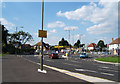
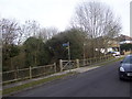
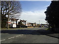
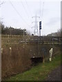
35 photos from this area
Area Information
Key information about the KT9 2BZ including its size, population, and administrative classification.
- Area Type
- Postcode
- Area Size
- 32.2 hectares
- Population
- 2527
- Population Density
- 1374 people/km²
House Prices in KT9 2BZ
50
Properties
£324,724
Average Sold Price
£71,500
Lowest Price
£581,000
Highest Price
Showing 50 properties
| Address | Type | Beds | Baths | Last Sale Price | Last Sale Date | |
|---|---|---|---|---|---|---|
| 24 Rollesby Road, Chessington, KT9 2BZ | Terraced | 3 | 1 | £515,000 | Mar 2025 | |
| 100 Rollesby Road, Chessington, KT9 2BZ | Terraced | 3 | 1 | £500,000 | Sep 2024 | |
| 50 Rollesby Road, Chessington, KT9 2BZ | Terraced | 3 | 1 | £390,000 | Oct 2023 | |
| 44 Rollesby Road, Chessington, KT9 2BZ | Terraced | 2 | 2 | £415,000 | Apr 2023 | |
| 84 Rollesby Road, Chessington, KT9 2BZ | house | 2 | 1 | £444,000 | Apr 2023 | |
| 64 Rollesby Road, Chessington, KT9 2BZ | Terraced | 2 | - | £375,000 | Oct 2022 | |
| 22 Rollesby Road, Chessington, KT9 2BZ | Terraced | 4 | 1 | £581,000 | Sep 2021 | |
| 52 Rollesby Road, Chessington, KT9 2BZ | Terraced | 2 | 1 | £410,000 | Jul 2021 | |
| 26 Rollesby Road, Chessington, KT9 2BZ | Terraced | 3 | 1 | £428,000 | Mar 2020 | |
| 56 Rollesby Road, Chessington, KT9 2BZ | Terraced | 2 | 1 | £355,000 | Mar 2020 |
Page 1 of 5
Energy Efficiency in KT9 2BZ
Amenities
Schools
| Rank | School | Type | Entry gender | Ages |
|---|
Explore more schools in this area
Go to Schools tabDemographics
Household Size
Family (3-5 people)
most common
Accommodation Type
Houses
most common
Tenure
85
majority
Ethnic Group
White
most common
Religion
N/A
most common
Household Composition
N/A
most common
Age
47
median
Adults (30-64 years)
most common
Household Deprivation
N/A
with no deprivation
NS-SEC
43
in Lower managerial occupations
Explore more demographic insights in this area
Go to Demographics tabPlanning
Planning Constraints
- Flood RiskPremium
- Ramsar Wetland SitesPremium
- Area of Outstanding Natural BeautyPremium
- Protected Nature ReservePremium
- Protected WoodlandPremium