Area Overview for KT18 7HY
Photos of KT18 7HY
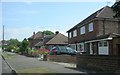
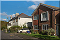
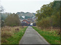
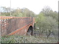
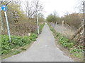
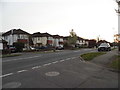
29 photos from this area
Area Information
Key information about the KT18 7HY including its size, population, and administrative classification.
- Area Type
- Postcode
- Area Size
- 8.8 hectares
- Population
- 1324
- Population Density
- 2126 people/km²
House Prices in KT18 7HY
42
Properties
£382,773
Average Sold Price
£113,500
Lowest Price
£610,000
Highest Price
Showing 42 properties
| Address | Type | Beds | Baths | Last Sale Price | Last Sale Date | |
|---|---|---|---|---|---|---|
| 67 The Greenway, Epsom, KT18 7HY | Terraced | 3 | 1 | £560,000 | Aug 2025 | |
| 121 The Greenway, Epsom, KT18 7HY | Semi-detached | 4 | 4 | £590,000 | Sep 2024 | |
| 77 The Greenway, Epsom, KT18 7HY | Terraced | 3 | 1 | £515,000 | Aug 2024 | |
| 117 The Greenway, Epsom, KT18 7HY | Semi-detached | 3 | 2 | £545,000 | Nov 2023 | |
| 75 The Greenway, Epsom, KT18 7HY | Terraced | 3 | - | £490,000 | Sep 2021 | |
| 119 The Greenway, Epsom, KT18 7HY | Bungalow | - | - | £405,000 | Nov 2020 | |
| 71 The Greenway, Epsom, KT18 7HY | Terraced | 3 | 1 | £397,288 | Jan 2020 | |
| 95 The Greenway, Epsom, KT18 7HY | Semi-detached | 4 | 3 | £610,000 | Nov 2019 | |
| 107 The Greenway, Epsom, KT18 7HY | house | 3 | 1 | £405,000 | May 2018 | |
| 135 The Greenway, Epsom, KT18 7HY | Semi-detached | 3 | 1 | £445,000 | May 2018 |
Page 1 of 5
Energy Efficiency in KT18 7HY
Amenities
Schools
| Rank | School | Type | Entry gender | Ages |
|---|
Explore more schools in this area
Go to Schools tabDemographics
Household Size
Family (3-5 people)
most common
Accommodation Type
Houses
most common
Tenure
96
majority
Ethnic Group
White
most common
Religion
N/A
most common
Household Composition
N/A
most common
Age
47
median
Adults (30-64 years)
most common
Household Deprivation
N/A
with no deprivation
NS-SEC
54
in Lower managerial occupations
Explore more demographic insights in this area
Go to Demographics tabPlanning
Planning Constraints
- Flood RiskPremium
- Ramsar Wetland SitesPremium
- Area of Outstanding Natural BeautyPremium
- Protected Nature ReservePremium
- Protected WoodlandPremium