Area Overview for KT17 4AR
Photos of KT17 4AR

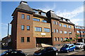
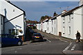
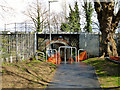
33 photos from this area
Area Information
Key information about the KT17 4AR including its size, population, and administrative classification.
- Area Type
- Postcode
- Area Size
- 7455 m²
- Population
- 1542
- Population Density
- 3301 people/km²
House Prices in KT17 4AR
14
Properties
£755,500
Average Sold Price
£270,000
Lowest Price
£1,600,000
Highest Price
Showing 14 properties
| Address | Type | Beds | Baths | Last Sale Price | Last Sale Date | |
|---|---|---|---|---|---|---|
| 44 Mill Road, Epsom, KT17 4AR | Semi-detached | 3 | 2 | £753,000 | Dec 2023 | |
| 18 Mill Road, Epsom, KT17 4AR | Retail | 2 | 1 | £1,600,000 | Dec 2017 | |
| The Gables, 42 Mill Road, Epsom, KT17 4AR | Detached | 5 | 1 | £1,110,000 | Jul 2017 | |
| 46 Mill Road, Epsom, KT17 4AR | Semi-detached | 3 | 1 | £665,000 | May 2016 | |
| 28 Mill Road, Epsom, KT17 4AR | Detached | 2 | 1 | £707,000 | Oct 2015 | |
| 30 Mill Road, Epsom, KT17 4AR | Detached | 3 | 2 | £820,000 | Jun 2015 | |
| 38 Mill Road, Epsom, KT17 4AR | house | 3 | - | £480,000 | Jun 2011 | |
| Beech Hedge Cottage, 22 Mill Road, Epsom, KT17 4AR | Retail | 4 | 1 | £570,000 | Jul 2010 | |
| 40 Mill Road, Epsom, KT17 4AR | Retirement | - | - | £580,000 | Aug 2007 | |
| 48 Mill Road, Epsom, KT17 4AR | Detached | - | - | £270,000 | Dec 1998 |
Page 1 of 2
Energy Efficiency in KT17 4AR
Amenities
Schools
| Rank | School | Type | Entry gender | Ages |
|---|
Explore more schools in this area
Go to Schools tabDemographics
Household Size
Family (3-5 people)
most common
Accommodation Type
Houses
most common
Tenure
66
majority
Ethnic Group
White
most common
Religion
N/A
most common
Household Composition
N/A
most common
Age
47
median
Adults (30-64 years)
most common
Household Deprivation
N/A
with no deprivation
NS-SEC
53
in Lower managerial occupations
Explore more demographic insights in this area
Go to Demographics tabPlanning
Planning Constraints
- Flood RiskPremium
- Ramsar Wetland SitesPremium
- Area of Outstanding Natural BeautyPremium
- Protected Nature ReservePremium
- Protected WoodlandPremium