Area Overview for KT17 1HY
Photos of KT17 1HY
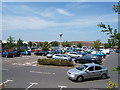
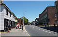
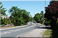

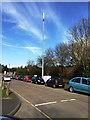

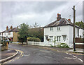
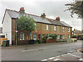
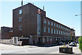
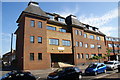

33 photos from this area
Area Information
Key information about the KT17 1HY including its size, population, and administrative classification.
- Area Type
- Postcode
- Area Size
- 1.6 hectares
- Population
- 1909
- Population Density
- 5099 people/km²
House Prices in KT17 1HY
40
Properties
£529,614
Average Sold Price
£140,000
Lowest Price
£1,215,000
Highest Price
Showing 40 properties
| Address | Type | Beds | Baths | Last Sale Price | Last Sale Date | |
|---|---|---|---|---|---|---|
| 24 Windmill Lane, Epsom, KT17 1HY | Bungalow | 3 | 2 | £750,000 | Oct 2023 | |
| 15 Windmill Lane, Epsom, KT17 1HY | Detached | 3 | 1 | £760,000 | Aug 2023 | |
| Bush Lodge, Windmill Lane, Epsom, KT17 1HY | house | - | - | £1,215,000 | Sep 2022 | |
| 10 Windmill Lane, Epsom, KT17 1HY | house | - | - | £715,000 | Apr 2022 | |
| 19 Windmill Lane, Epsom, KT17 1HY | Detached | 6 | 3 | £890,000 | Mar 2021 | |
| 11 Windmill Lane, Epsom, KT17 1HY | house | - | - | £902,500 | Oct 2020 | |
| 5A Windmill Lane, Epsom, KT17 1HY | Semi-detached | 4 | 3 | £580,000 | Jan 2018 | |
| 13 Windmill Lane, Epsom, KT17 1HY | Bungalow | 3 | - | £510,000 | Feb 2017 | |
| The Whym, 28 Windmill Lane, Epsom, KT17 1HY | Detached | 2 | 2 | £635,000 | Dec 2016 | |
| 3A Windmill Lane, Epsom, KT17 1HY | Terraced | 2 | 1 | £470,000 | Nov 2014 |
Page 1 of 4
Energy Efficiency in KT17 1HY
Amenities
Schools
| Rank | School | Type | Entry gender | Ages |
|---|
Explore more schools in this area
Go to Schools tabDemographics
Household Size
Two person
most common
Accommodation Type
Houses
most common
Tenure
70
majority
Ethnic Group
White
most common
Religion
N/A
most common
Household Composition
N/A
most common
Age
47
median
Adults (30-64 years)
most common
Household Deprivation
N/A
with no deprivation
NS-SEC
45
in Lower managerial occupations
Explore more demographic insights in this area
Go to Demographics tabPlanning
Planning Constraints
- Flood RiskPremium
- Ramsar Wetland SitesPremium
- Area of Outstanding Natural BeautyPremium
- Protected Nature ReservePremium
- Protected WoodlandPremium