Area Overview for KT17 2RG
Photos of KT17 2RG
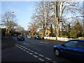
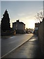
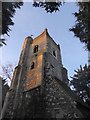
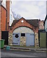
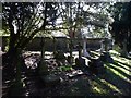

74 photos from this area
Area Information
Key information about the KT17 2RG including its size, population, and administrative classification.
- Area Type
- Postcode
- Area Size
- 2.5 hectares
- Population
- Not available
- Population Density
- Not available
House Prices in KT17 2RG
24
Properties
£592,100
Average Sold Price
£150,000
Lowest Price
£1,210,000
Highest Price
Showing 24 properties
| Address | Type | Beds | Baths | Last Sale Price | Last Sale Date | |
|---|---|---|---|---|---|---|
| 2 Arundel Avenue, Ewell, KT17 2RG | Detached | 4 | 2 | £1,210,000 | Jan 2024 | |
| 42 Arundel Avenue, Ewell, KT17 2RG | Detached | 3 | 1 | £940,000 | Aug 2023 | |
| 24 Arundel Avenue, Ewell, KT17 2RG | Detached | 4 | - | £925,000 | Sep 2021 | |
| 28 Arundel Avenue, Ewell, KT17 2RG | Detached | 5 | 3 | £1,000,000 | Nov 2019 | |
| 34 Arundel Avenue, Ewell, KT17 2RG | Detached | 4 | - | £800,000 | Jan 2016 | |
| 36 Arundel Avenue, Ewell, KT17 2RG | Detached | 4 | 3 | £678,000 | Aug 2015 | |
| 32 Arundel Avenue, Ewell, KT17 2RG | house | 3 | - | £620,000 | Jul 2011 | |
| 38 Arundel Avenue, Ewell, KT17 2RG | Detached | - | - | £590,000 | Jul 2007 | |
| 20 Arundel Avenue, Ewell, KT17 2RG | house | - | - | £495,000 | Jul 2007 | |
| 8 Arundel Avenue, Ewell, KT17 2RG | Detached | - | - | £387,500 | Aug 2002 |
Page 1 of 3
Energy Efficiency in KT17 2RG
Amenities
Schools
| Rank | School | Type | Entry gender | Ages |
|---|
Explore more schools in this area
Go to Schools tabDemographics
Household Size
Family (3-5 people)
most common
Accommodation Type
Houses
most common
Tenure
96
majority
Ethnic Group
White
most common
Religion
N/A
most common
Household Composition
N/A
most common
Age
47
median
Adults (30-64 years)
most common
Household Deprivation
N/A
with no deprivation
NS-SEC
51
in Lower managerial occupations
Explore more demographic insights in this area
Go to Demographics tabPlanning
Planning Constraints
- Flood RiskPremium
- Ramsar Wetland SitesPremium
- Area of Outstanding Natural BeautyPremium
- Protected Nature ReservePremium
- Protected WoodlandPremium