Area Overview for KT17 2RZ
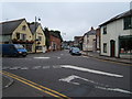
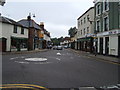
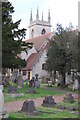
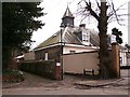
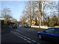
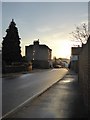
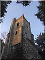
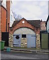
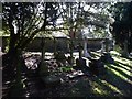
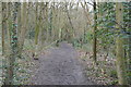
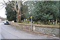
Photos of KT17 2RZ

Area Information
KT17 2RZ is a small residential postcode in England, home to 1972 people spread across a cluster of homes. This area is defined by its quiet, settled character, with a population skewed towards adults aged 30–64, reflecting a mature, stable community. The high rate of home ownership (96%) suggests a long-term presence of residents, many of whom are likely families or individuals seeking a peaceful, low-maintenance lifestyle. Daily life here is shaped by proximity to essential services, including multiple rail stations, retail outlets, and transport links. The area’s compact size means amenities are within practical reach, though it remains a niche postcode with limited housing stock. For those prioritising safety, low crime rates and no flood or environmental risks make it an attractive option. The mix of houses and proximity to transport hubs like Ewell East and Stoneleigh stations offer a balance between seclusion and connectivity.
- Area Type
- Postcode
- Area Size
- Not available
- Population
- Not available
- Population Density
- Not available
KT17 2RZ is a predominantly owner-occupied area, with 96% of properties owned by residents rather than rented out. The housing stock consists almost entirely of houses, which is unusual for a postcode of this size and suggests a focus on family homes or larger properties. This makes the area less suited to those seeking rental opportunities or smaller living spaces. The limited number of properties means the market is likely competitive for buyers, with limited scope for new developments. For those considering the area, the high home ownership rate indicates a community of long-term residents, which may influence the character and pace of change. Buyers should note that the small size of KT17 2RZ means housing options are restricted to the immediate vicinity, with few alternatives nearby.
House Prices in KT17 2RZ
No properties found in this postcode.
Energy Efficiency in KT17 2RZ
Living in KT17 2RZ offers access to a range of practical amenities, including five retail outlets such as Tesco Ewell, Sainsburys Ewell, and Co-op Ewell, ensuring everyday shopping needs are met. The proximity to rail stations like Ewell East and Stoneleigh, along with metro stops such as Morden and Mitcham Tram Stop, provides multiple transport options for commuting or leisure travel. Ferry services at Kingston Town End Pier and Ditton Island add versatility to local travel, particularly for those near waterways. While the area lacks explicit references to parks or leisure facilities, the presence of multiple retail and transport hubs suggests a lifestyle focused on convenience and accessibility. The mix of shops, transport links, and nearby services creates a functional, community-oriented environment.
Amenities
Schools
| Rank | School | Type | Entry gender | Ages |
|---|
Explore more schools in this area
Go to Schools tabDemographics
The population of KT17 2RZ has a median age of 47, with the majority of residents falling within the 30–64 age range. This suggests a community of established adults, likely with families, who have remained in the area over time. Home ownership is exceptionally high at 96%, indicating a strong preference for long-term residency rather than rental properties. The accommodation type is predominantly houses, reflecting a focus on single-family homes rather than apartments or flats. The predominant ethnic group is White, though no further breakdown of diversity is provided. The absence of specific data on deprivation means no direct conclusions can be drawn about economic disparities, but the high home ownership rate and low crime score imply a relatively stable quality of life for residents.
Household Size
Accommodation Type
Tenure
Ethnic Group
Religion
Household Composition
Age
Household Deprivation
NS-SEC
Explore more demographic insights in this area
Go to Demographics tabPlanning
Planning Constraints
- Flood RiskPremium
- Ramsar Wetland SitesPremium
- Area of Outstanding Natural BeautyPremium
- Protected Nature ReservePremium
- Protected WoodlandPremium