Area Overview for KT17 2NF
Photos of KT17 2NF
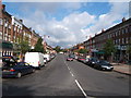

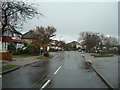
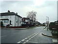
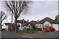
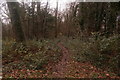
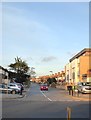
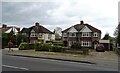
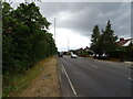
31 photos from this area
Area Information
Key information about the KT17 2NF including its size, population, and administrative classification.
- Area Type
- Postcode
- Area Size
- 9957 m²
- Population
- 1555
- Population Density
- 4563 people/km²
House Prices in KT17 2NF
17
Properties
£445,377
Average Sold Price
£145,000
Lowest Price
£725,000
Highest Price
Showing 17 properties
| Address | Type | Beds | Baths | Last Sale Price | Last Sale Date | |
|---|---|---|---|---|---|---|
| 14 Kenilworth Road, Stoneleigh, KT17 2NF | house | - | - | £660,000 | Jun 2025 | |
| 17 Kenilworth Road, Stoneleigh, KT17 2NF | Semi-detached | 3 | 1 | £620,000 | Mar 2024 | |
| 7 Kenilworth Road, Stoneleigh, KT17 2NF | Semi-detached | 4 | 2 | £725,000 | Sep 2023 | |
| 12 Kenilworth Road, Stoneleigh, KT17 2NF | house | - | - | £500,000 | Dec 2020 | |
| 9 Kenilworth Road, Stoneleigh, KT17 2NF | Semi-detached | 4 | 1 | £515,000 | Jan 2017 | |
| 16 Kenilworth Road, Stoneleigh, KT17 2NF | Semi-detached | 4 | 2 | £594,950 | Jul 2015 | |
| 13 Kenilworth Road, Stoneleigh, KT17 2NF | house | 3 | - | £424,950 | Dec 2013 | |
| 5 Kenilworth Road, Stoneleigh, KT17 2NF | house | - | - | £320,000 | Jan 2013 | |
| 10 Kenilworth Road, Stoneleigh, KT17 2NF | Semi-detached | 3 | 1 | £330,000 | Jun 2008 | |
| 15 Kenilworth Road, Stoneleigh, KT17 2NF | Semi-detached | - | - | £450,000 | Aug 2007 |
Page 1 of 2
Energy Efficiency in KT17 2NF
Amenities
Schools
| Rank | School | Type | Entry gender | Ages |
|---|
Explore more schools in this area
Go to Schools tabDemographics
Household Size
Family (3-5 people)
most common
Accommodation Type
Houses
most common
Tenure
77
majority
Ethnic Group
White
most common
Religion
N/A
most common
Household Composition
N/A
most common
Age
47
median
Adults (30-64 years)
most common
Household Deprivation
N/A
with no deprivation
NS-SEC
44
in Lower managerial occupations
Explore more demographic insights in this area
Go to Demographics tabPlanning
Planning Constraints
- Flood RiskPremium
- Ramsar Wetland SitesPremium
- Area of Outstanding Natural BeautyPremium
- Protected Nature ReservePremium
- Protected WoodlandPremium