Area Overview for KT17 2JA
Photos of KT17 2JA
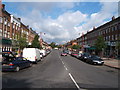
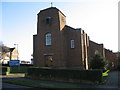
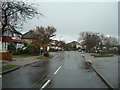
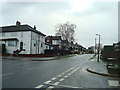
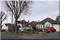
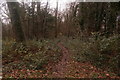
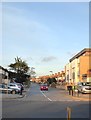
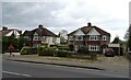
31 photos from this area
Area Information
Key information about the KT17 2JA including its size, population, and administrative classification.
- Area Type
- Postcode
- Area Size
- 1.2 hectares
- Population
- 1555
- Population Density
- 4563 people/km²
House Prices in KT17 2JA
19
Properties
£225,417
Average Sold Price
£152,500
Lowest Price
£354,000
Highest Price
Showing 19 properties
| Address | Type | Beds | Baths | Last Sale Price | Last Sale Date | |
|---|---|---|---|---|---|---|
| 11A Stoneleigh Broadway, Stoneleigh, KT17 2JA | Maisonette | 2 | 1 | £155,000 | Sep 2024 | |
| 7A Stoneleigh Broadway, Stoneleigh, KT17 2JA | Flat | 2 | 1 | £342,000 | Aug 2024 | |
| 21A Stoneleigh Broadway, Stoneleigh, KT17 2JA | Maisonette | 2 | 1 | £354,000 | Sep 2022 | |
| 13A Stoneleigh Broadway, Stoneleigh, KT17 2JA | Maisonette | 2 | 1 | £152,500 | Aug 2022 | |
| 15A Stoneleigh Broadway, Stoneleigh, KT17 2JA | Flat | 2 | 1 | £174,000 | Mar 2009 | |
| 17A Stoneleigh Broadway, Stoneleigh, KT17 2JA | Flat | - | - | £175,000 | Oct 2006 | |
| 5A Stoneleigh Broadway, Stoneleigh, KT17 2JA | Flat | 2 | 1 | - | - | |
| 1A Stoneleigh Broadway, Stoneleigh, KT17 2JA | Maisonette | 2 | 1 | - | - | |
| 9A Stoneleigh Broadway, Stoneleigh, KT17 2JA | Maisonette | 2 | 1 | - | - | |
| 1 STONELEIGH BROADWAY, Stoneleigh, KT17 2JA | Flat | - | - | - | - |
Page 1 of 2
Energy Efficiency in KT17 2JA
Amenities
Schools
| Rank | School | Type | Entry gender | Ages |
|---|
Explore more schools in this area
Go to Schools tabDemographics
Household Size
Family (3-5 people)
most common
Accommodation Type
Houses
most common
Tenure
77
majority
Ethnic Group
White
most common
Religion
N/A
most common
Household Composition
N/A
most common
Age
47
median
Adults (30-64 years)
most common
Household Deprivation
N/A
with no deprivation
NS-SEC
44
in Lower managerial occupations
Explore more demographic insights in this area
Go to Demographics tabPlanning
Planning Constraints
- Flood RiskPremium
- Ramsar Wetland SitesPremium
- Area of Outstanding Natural BeautyPremium
- Protected Nature ReservePremium
- Protected WoodlandPremium