Area Overview for KT16 9QS
Photos of KT16 9QS
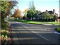
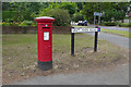
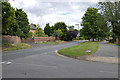
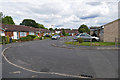
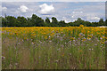
51 photos from this area
Area Information
Key information about the KT16 9QS including its size, population, and administrative classification.
- Area Type
- Postcode
- Area Size
- 1.4 hectares
- Population
- 1861
- Population Density
- 1618 people/km²
House Prices in KT16 9QS
19
Properties
£484,042
Average Sold Price
£74,000
Lowest Price
£775,295
Highest Price
Showing 19 properties
| Address | Type | Beds | Baths | Last Sale Price | Last Sale Date | |
|---|---|---|---|---|---|---|
| 361 Green Lane, Chertsey, KT16 9QS | Bungalow | 5 | 2 | £635,000 | Mar 2024 | |
| 333 Green Lane, Chertsey, KT16 9QS | Detached | 4 | 3 | £600,000 | Oct 2022 | |
| Chimes, 367 Green Lane, Chertsey, KT16 9QS | house | 4 | 2 | £655,000 | Jul 2022 | |
| 345 Green Lane, Chertsey, KT16 9QS | Bungalow | 4 | 3 | £700,000 | Nov 2021 | |
| 337 Green Lane, Chertsey, KT16 9QS | Bungalow | - | - | £750,000 | Jun 2021 | |
| 339 Green Lane, Chertsey, KT16 9QS | Detached | 4 | 3 | £700,000 | Jun 2021 | |
| 341 Green Lane, Chertsey, KT16 9QS | Detached | 4 | 3 | £775,295 | Jun 2021 | |
| 359 Green Lane, Chertsey, KT16 9QS | Bungalow | 3 | 2 | £650,000 | Sep 2020 | |
| 343 Green Lane, Chertsey, KT16 9QS | Bungalow | - | - | £525,000 | Nov 2015 | |
| 355 Green Lane, Chertsey, KT16 9QS | Bungalow | 3 | 1 | £470,000 | Aug 2015 |
Page 1 of 2
Energy Efficiency in KT16 9QS
Amenities
Schools
| Rank | School | Type | Entry gender | Ages |
|---|
Explore more schools in this area
Go to Schools tabDemographics
Household Size
Family (3-5 people)
most common
Accommodation Type
Houses
most common
Tenure
76
majority
Ethnic Group
White
most common
Religion
N/A
most common
Household Composition
N/A
most common
Age
47
median
Adults (30-64 years)
most common
Household Deprivation
N/A
with no deprivation
NS-SEC
45
in Lower managerial occupations
Explore more demographic insights in this area
Go to Demographics tabPlanning
Planning Constraints
- Flood RiskPremium
- Ramsar Wetland SitesPremium
- Area of Outstanding Natural BeautyPremium
- Protected Nature ReservePremium
- Protected WoodlandPremium