Area Overview for KT16 9QN
Photos of KT16 9QN
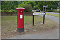
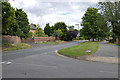
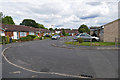
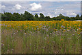
51 photos from this area
Area Information
Key information about the KT16 9QN including its size, population, and administrative classification.
- Area Type
- Postcode
- Area Size
- 8927 m²
- Population
- 1861
- Population Density
- 1618 people/km²
House Prices in KT16 9QN
13
Properties
£356,800
Average Sold Price
£237,000
Lowest Price
£502,500
Highest Price
Showing 13 properties
| Address | Type | Beds | Baths | Last Sale Price | Last Sale Date | |
|---|---|---|---|---|---|---|
| 9 Bretlands Road, Chertsey, KT16 9QN | Semi-detached | 3 | 1 | £490,000 | Feb 2025 | |
| 7 Bretlands Road, Chertsey, KT16 9QN | Semi-detached | 3 | 1 | £502,500 | Aug 2024 | |
| 12 Bretlands Road, Chertsey, KT16 9QN | house | 3 | - | £420,000 | Mar 2021 | |
| 3 Bretlands Road, Chertsey, KT16 9QN | Semi-detached | 4 | 2 | £422,500 | Mar 2018 | |
| 8 Bretlands Road, Chertsey, KT16 9QN | Semi-detached | 3 | - | £315,000 | Dec 2013 | |
| 4 Bretlands Road, Chertsey, KT16 9QN | house | - | - | £274,250 | May 2013 | |
| 5 Bretlands Road, Chertsey, KT16 9QN | house | - | - | £275,000 | Apr 2012 | |
| 11 Bretlands Road, Chertsey, KT16 9QN | Semi-detached | - | - | £274,950 | Apr 2007 | |
| 10 Bretlands Road, Chertsey, KT16 9QN | Semi-detached | - | - | £237,000 | Nov 2004 | |
| 6 Bretlands Road, Chertsey, KT16 9QN | Semi-detached | 3 | 1 | - | - |
Page 1 of 2
Energy Efficiency in KT16 9QN
Amenities
Schools
| Rank | School | Type | Entry gender | Ages |
|---|
Explore more schools in this area
Go to Schools tabDemographics
Household Size
Family (3-5 people)
most common
Accommodation Type
Houses
most common
Tenure
76
majority
Ethnic Group
White
most common
Religion
N/A
most common
Household Composition
N/A
most common
Age
47
median
Adults (30-64 years)
most common
Household Deprivation
N/A
with no deprivation
NS-SEC
45
in Lower managerial occupations
Explore more demographic insights in this area
Go to Demographics tabPlanning
Planning Constraints
- Flood RiskPremium
- Ramsar Wetland SitesPremium
- Area of Outstanding Natural BeautyPremium
- Protected Nature ReservePremium
- Protected WoodlandPremium