Area Overview for KT12 1NL
Photos of KT12 1NL

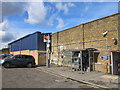

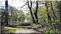

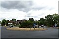
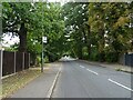

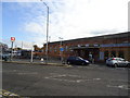
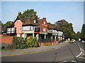
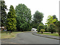

24 photos from this area
Area Information
Key information about the KT12 1NL including its size, population, and administrative classification.
- Area Type
- Postcode
- Area Size
- 6948 m²
- Population
- 1956
- Population Density
- 3988 people/km²
House Prices in KT12 1NL
28
Properties
£370,431
Average Sold Price
£137,500
Lowest Price
£600,000
Highest Price
Showing 28 properties
| Address | Type | Beds | Baths | Last Sale Price | Last Sale Date | |
|---|---|---|---|---|---|---|
| 66 Gainsborough Court, Walton On Thames, KT12 1NL | Flat | - | - | £325,000 | Sep 2024 | |
| 80 Gainsborough Court, Walton On Thames, KT12 1NL | Terraced | 4 | 2 | £600,000 | May 2024 | |
| 104 Gainsborough Court, Walton On Thames, KT12 1NL | Terraced | 4 | 2 | £585,000 | Feb 2024 | |
| 76 Gainsborough Court, Walton On Thames, KT12 1NL | Terraced | 4 | 2 | £549,950 | Sep 2021 | |
| 108 Gainsborough Court, Walton On Thames, KT12 1NL | house | - | - | £495,000 | Jun 2021 | |
| 78 Gainsborough Court, Walton On Thames, KT12 1NL | Terraced | 3 | 2 | £530,000 | Mar 2020 | |
| 106 Gainsborough Court, Walton On Thames, KT12 1NL | Terraced | 4 | 2 | £520,000 | Jun 2019 | |
| 100 Gainsborough Court, Walton On Thames, KT12 1NL | house | 4 | 2 | £512,000 | May 2019 | |
| 62 Gainsborough Court, Walton On Thames, KT12 1NL | Flat | - | - | £285,500 | Aug 2014 | |
| 82 Gainsborough Court, Walton On Thames, KT12 1NL | Terraced | - | - | £310,000 | Mar 2006 |
Page 1 of 3
Energy Efficiency in KT12 1NL
Amenities
Schools
| Rank | School | Type | Entry gender | Ages |
|---|
Explore more schools in this area
Go to Schools tabDemographics
Household Size
One person
most common
Accommodation Type
Flats
most common
Tenure
56
majority
Ethnic Group
White
most common
Religion
N/A
most common
Household Composition
N/A
most common
Age
47
median
Adults (30-64 years)
most common
Household Deprivation
N/A
with no deprivation
NS-SEC
49
in Lower managerial occupations
Explore more demographic insights in this area
Go to Demographics tabPlanning
Planning Constraints
- Flood RiskPremium
- Ramsar Wetland SitesPremium
- Area of Outstanding Natural BeautyPremium
- Protected Nature ReservePremium
- Protected WoodlandPremium