Area Overview for KT11 2SJ
Photos of KT11 2SJ
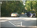
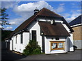
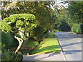
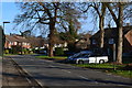
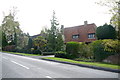
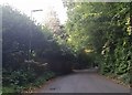
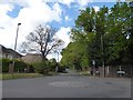
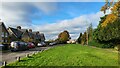

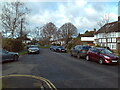
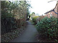
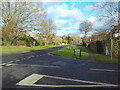
29 photos from this area
Area Information
Key information about the KT11 2SJ including its size, population, and administrative classification.
- Area Type
- Postcode
- Area Size
- 2.8 hectares
- Population
- 1821
- Population Density
- 507 people/km²
House Prices in KT11 2SJ
21
Properties
£845,000
Average Sold Price
£620,000
Lowest Price
£1,150,000
Highest Price
Showing 21 properties
| Address | Type | Beds | Baths | Last Sale Price | Last Sale Date | |
|---|---|---|---|---|---|---|
| Sennen Cottage, Evelyn Way, Stoke Dabernon, Cobham, KT11 2SJ | Detached | 3 | 1 | £850,000 | Sep 2023 | |
| Meadowside Cottage, Evelyn Way, Stoke Dabernon, Cobham, KT11 2SJ | house | - | - | £1,150,000 | Mar 2023 | |
| Foresta, Evelyn Way, Stoke Dabernon, Cobham, KT11 2SJ | Detached | 3 | 3 | £760,000 | Nov 2014 | |
| Sandalwood, Evelyn Way, Stoke Dabernon, Cobham, KT11 2SJ | Detached | - | - | £620,000 | Sep 2012 | |
| Glenayr, Evelyn Way, Stoke Dabernon, Cobham, KT11 2SJ | Detached | 4 | 2 | - | - | |
| Trafton, Evelyn Way, Stoke Dabernon, Cobham, KT11 2SJ | Detached | 3 | 1 | - | - | |
| Oakley, Evelyn Way, Stoke Dabernon, Cobham, KT11 2SJ | Detached | 5 | 4 | - | - | |
| Margarita, Evelyn Way, Stoke Dabernon, Cobham, KT11 2SJ | Detached | 4 | 3 | - | - | |
| Heatherbank, Evelyn Way, Stoke Dabernon, Cobham, KT11 2SJ | Detached | 5 | 3 | - | - | |
| Helford, Evelyn Way, Stoke Dabernon, Cobham, KT11 2SJ | Detached | 4 | 2 | - | - |
Page 1 of 3
Energy Efficiency in KT11 2SJ
Amenities
Schools
| Rank | School | Type | Entry gender | Ages |
|---|
Explore more schools in this area
Go to Schools tabDemographics
Household Size
Family (3-5 people)
most common
Accommodation Type
Houses
most common
Tenure
79
majority
Ethnic Group
White
most common
Religion
N/A
most common
Household Composition
N/A
most common
Age
47
median
Adults (30-64 years)
most common
Household Deprivation
N/A
with no deprivation
NS-SEC
57
in Lower managerial occupations
Explore more demographic insights in this area
Go to Demographics tabPlanning
Planning Constraints
- Flood RiskPremium
- Ramsar Wetland SitesPremium
- Area of Outstanding Natural BeautyPremium
- Protected Nature ReservePremium
- Protected WoodlandPremium