Area Overview for KT11 2SB
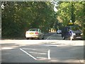
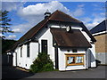
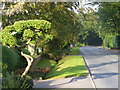
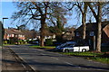
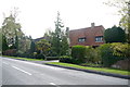
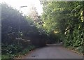
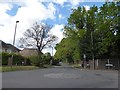
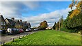
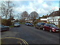
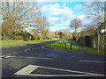
Photos of KT11 2SB

Area Information
KT11 2SB is a small residential postcode area in England, home to 1,821 people spread across a compact footprint. With a population density of 507 people per square kilometre, it reflects a tightly knit community rather than a sprawling suburb. This area is defined by its proximity to local amenities, including independent schools, retail hubs, and transport links. The median age of 47 suggests a mature population, with adults aged 30–64 forming the largest demographic group. Home ownership is high at 79%, indicating a stable, long-term resident base. While the area lacks large-scale infrastructure, its charm lies in its accessibility to nearby towns and natural features. Residents benefit from a mix of practical amenities, from rail stations to ferry landings, making it a convenient base for commuters or those seeking a quieter lifestyle. The absence of environmental constraints like protected woodlands or Areas of Outstanding Natural Beauty means development is less restricted, though flood risk remains negligible. KT11 2SB offers a balanced blend of residential comfort and connectivity, ideal for those prioritising safety, community cohesion, and proximity to services.
- Area Type
- Postcode
- Area Size
- Not available
- Population
- 1821
- Population Density
- 507 people/km²
KT11 2SB is primarily an owner-occupied area, with 79% of homes owned by residents rather than rented. The housing stock consists predominantly of houses, which are more common than flats in this postcode. This suggests a suburban or semi-rural character, with properties likely offering larger living spaces and gardens. As a small postcode area, the property market may be limited in scale, with fewer listings compared to larger towns. Buyers should consider the proximity to nearby towns and amenities, as the immediate surroundings may offer additional options. The high home ownership rate indicates a stable market, though competition for properties could be fierce due to the area’s appeal. For those seeking a family home or a long-term investment, KT11 2SB’s housing stock aligns with traditional needs, though its small size means buyers may need to look beyond the postcode for more extensive choices.
House Prices in KT11 2SB
No properties found in this postcode.
Energy Efficiency in KT11 2SB
Living in KT11 2SB offers access to a mix of practical amenities that support daily life. The nearby rail stations, including Cobham & Stoke d’Abernon and Oxshott, provide easy access to commuting routes, while the retail hubs in Cobham—such as Sainsburys, Waitrose, and M&S—offer shopping and dining options. Ferry landings at Weybridge, Shepperton, and Ditton Island add flexibility for those reliant on water transport. While the area lacks large parks or leisure facilities, its proximity to surrounding towns likely expands recreational opportunities. The presence of multiple rail stations and retail centres suggests a lifestyle that balances convenience with a quieter, residential environment. For those valuing accessibility without urban density, KT11 2SB provides a functional base with minimal need to travel far for essentials.
Amenities
Schools
The nearest school to KT11 2SB is Parkside School, an independent institution. While no Ofsted rating is provided, the presence of an independent school may indicate a focus on private education within the community. This could appeal to families prioritising specific curricula or smaller class sizes. However, the data does not list additional schools, so parents seeking state-funded options may need to look further afield. The absence of other schools in the immediate vicinity suggests that residents might rely on nearby towns for broader educational choices. For those valuing independent schooling, Parkside School offers a dedicated option, but its standalone status means the area does not host a diverse range of educational institutions.
| Rank | School | Type | Entry gender | Ages |
|---|
Explore more schools in this area
Go to Schools tabDemographics
The community in KT11 2SB is predominantly composed of adults aged 30–64, with a median age of 47. This suggests a population that is largely established in careers and family life, contributing to a stable local economy. Home ownership is high at 79%, indicating a strong presence of long-term residents. The area is characterised by houses rather than flats, reflecting a traditional, suburban housing stock. The predominant ethnic group is White, though the data does not specify further diversity metrics. With a population density of 507 people per square kilometre, the area maintains a low-key, neighbourly atmosphere. The absence of specific deprivation data means the quality of life cannot be assessed in that context, but the high home ownership and mature age profile suggest a community focused on stability and continuity. This demographic profile may appeal to families seeking a settled environment with established local networks.
Household Size
Accommodation Type
Tenure
Ethnic Group
Religion
Household Composition
Age
Household Deprivation
NS-SEC
Explore more demographic insights in this area
Go to Demographics tabPlanning
Planning Constraints
- Flood RiskPremium
- Ramsar Wetland SitesPremium
- Area of Outstanding Natural BeautyPremium
- Protected Nature ReservePremium
- Protected WoodlandPremium