Area Overview for KT10 8PS
Photos of KT10 8PS
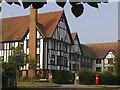
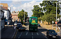
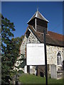
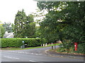
100 photos from this area
Area Information
Key information about the KT10 8PS including its size, population, and administrative classification.
- Area Type
- Postcode
- Area Size
- 4.3 hectares
- Population
- 1736
- Population Density
- 1554 people/km²
House Prices in KT10 8PS
33
Properties
£1,517,175
Average Sold Price
£385,000
Lowest Price
£2,900,000
Highest Price
Showing 33 properties
| Address | Type | Beds | Baths | Last Sale Price | Last Sale Date | |
|---|---|---|---|---|---|---|
| 1 Clive Road, Esher, KT10 8PS | house | 5 | 3 | £1,203,486 | Oct 2024 | |
| 14 Clive Road, Esher, KT10 8PS | Detached | 5 | 5 | £2,900,000 | Feb 2024 | |
| 34 Clive Road, Esher, KT10 8PS | Detached | 4 | 2 | £1,470,000 | Jun 2023 | |
| 4 Clive Road, Esher, KT10 8PS | house | - | - | £1,950,000 | Mar 2021 | |
| 24 Clive Road, Esher, KT10 8PS | Detached | 5 | 4 | £2,170,000 | Nov 2020 | |
| 23 Clive Road, Esher, KT10 8PS | Detached | 3 | 2 | £1,285,000 | Mar 2019 | |
| 32 Clive Road, Esher, KT10 8PS | Detached | 4 | 2 | £1,535,000 | Nov 2017 | |
| 6 Clive Road, Esher, KT10 8PS | Detached | 5 | - | £2,550,000 | Nov 2016 | |
| 9 Clive Road, Esher, KT10 8PS | house | 5 | - | £1,780,000 | Nov 2016 | |
| 7 Clive Road, Esher, KT10 8PS | Land | 4 | 2 | £2,000,000 | Jun 2014 |
Page 1 of 4
Energy Efficiency in KT10 8PS
Amenities
Schools
| Rank | School | Type | Entry gender | Ages |
|---|
Explore more schools in this area
Go to Schools tabDemographics
Household Size
Family (3-5 people)
most common
Accommodation Type
Houses
most common
Tenure
77
majority
Ethnic Group
White
most common
Religion
N/A
most common
Household Composition
N/A
most common
Age
47
median
Adults (30-64 years)
most common
Household Deprivation
N/A
with no deprivation
NS-SEC
53
in Lower managerial occupations
Explore more demographic insights in this area
Go to Demographics tabPlanning
Planning Constraints
- Flood RiskPremium
- Ramsar Wetland SitesPremium
- Area of Outstanding Natural BeautyPremium
- Protected Nature ReservePremium
- Protected WoodlandPremium