Area Overview for KT10 8NY
Photos of KT10 8NY
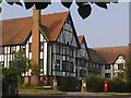
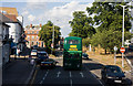
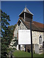
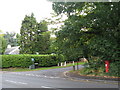
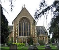
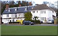

100 photos from this area
Area Information
Key information about the KT10 8NY including its size, population, and administrative classification.
- Area Type
- Postcode
- Area Size
- 1.5 hectares
- Population
- 1736
- Population Density
- 1554 people/km²
House Prices in KT10 8NY
17
Properties
£1,523,438
Average Sold Price
£592,500
Lowest Price
£2,235,000
Highest Price
Showing 17 properties
| Address | Type | Beds | Baths | Last Sale Price | Last Sale Date | |
|---|---|---|---|---|---|---|
| Former, 16 Lammas Lane, Esher, KT10 8NY | Detached | 5 | 4 | £1,860,000 | May 2025 | |
| Esher Crown House, 2 Lammas Lane, Esher, KT10 8NY | Detached | 5 | 4 | £1,600,000 | Apr 2025 | |
| Lime Light, 18 Lammas Lane, Esher, KT10 8NY | house | 5 | 4 | £1,860,000 | Apr 2024 | |
| 8 Lammas Lane, Esher, KT10 8NY | Detached | 8 | 3 | £2,235,000 | Apr 2023 | |
| 24 Lammas Lane, Esher, KT10 8NY | Detached | 6 | 4 | £1,450,000 | Dec 2018 | |
| Beech Hill House, 14 Lammas Lane, Esher, KT10 8NY | Detached | 5 | - | £1,640,000 | Nov 2015 | |
| 26 Lammas Lane, Esher, KT10 8NY | Detached | 4 | 1 | £950,000 | Mar 2008 | |
| 22 Lammas Lane, Esher, KT10 8NY | Detached | 5 | 2 | £592,500 | Sep 2002 | |
| 16 Lammas Lane, Esher, KT10 8NY | Detached | 5 | 4 | - | - | |
| 4 Lammas Lane, Esher, KT10 8NY | Detached | 4 | 2 | - | - |
Page 1 of 2
Energy Efficiency in KT10 8NY
Amenities
Schools
| Rank | School | Type | Entry gender | Ages |
|---|
Explore more schools in this area
Go to Schools tabDemographics
Household Size
Family (3-5 people)
most common
Accommodation Type
Houses
most common
Tenure
77
majority
Ethnic Group
White
most common
Religion
N/A
most common
Household Composition
N/A
most common
Age
47
median
Adults (30-64 years)
most common
Household Deprivation
N/A
with no deprivation
NS-SEC
53
in Lower managerial occupations
Explore more demographic insights in this area
Go to Demographics tabPlanning
Planning Constraints
- Flood RiskPremium
- Ramsar Wetland SitesPremium
- Area of Outstanding Natural BeautyPremium
- Protected Nature ReservePremium
- Protected WoodlandPremium