Area Overview for KT10 0LF
Photos of KT10 0LF
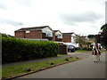
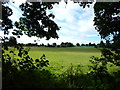
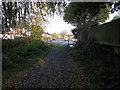
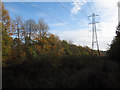
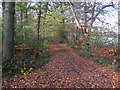
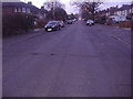
25 photos from this area
Area Information
Key information about the KT10 0LF including its size, population, and administrative classification.
- Area Type
- Postcode
- Area Size
- 6.6 hectares
- Population
- 1688
- Population Density
- 1633 people/km²
House Prices in KT10 0LF
42
Properties
£342,925
Average Sold Price
£150,000
Lowest Price
£599,950
Highest Price
Showing 42 properties
| Address | Type | Beds | Baths | Last Sale Price | Last Sale Date | |
|---|---|---|---|---|---|---|
| 4 Glebelands, Claygate, Esher, KT10 0LF | Detached | 3 | 2 | £572,500 | Sep 2024 | |
| 13 Glebelands, Claygate, Esher, KT10 0LF | Detached | 3 | 1 | £455,000 | Mar 2024 | |
| 24 Glebelands, Claygate, Esher, KT10 0LF | Maisonette | 2 | 1 | £325,000 | Aug 2023 | |
| 22 Glebelands, Claygate, Esher, KT10 0LF | Maisonette | 2 | 1 | £250,000 | Apr 2021 | |
| 27 Glebelands, Claygate, Esher, KT10 0LF | Detached | 4 | 1 | £599,950 | Feb 2021 | |
| 28 Glebelands, Claygate, Esher, KT10 0LF | Flat | - | - | £279,000 | Mar 2017 | |
| 10 Glebelands, Claygate, Esher, KT10 0LF | Detached | 4 | 3 | £528,000 | Oct 2016 | |
| 33 Glebelands, Claygate, Esher, KT10 0LF | Detached | 4 | 1 | £430,000 | Jul 2013 | |
| 3 Glebelands, Claygate, Esher, KT10 0LF | house | 3 | 1 | £356,500 | Aug 2011 | |
| 18 Glebelands, Claygate, Esher, KT10 0LF | Flat | - | - | £235,000 | Nov 2010 |
Page 1 of 5
Energy Efficiency in KT10 0LF
Amenities
Schools
| Rank | School | Type | Entry gender | Ages |
|---|
Explore more schools in this area
Go to Schools tabDemographics
Household Size
Family (3-5 people)
most common
Accommodation Type
Houses
most common
Tenure
78
majority
Ethnic Group
White
most common
Religion
N/A
most common
Household Composition
N/A
most common
Age
47
median
Adults (30-64 years)
most common
Household Deprivation
N/A
with no deprivation
NS-SEC
50
in Lower managerial occupations
Explore more demographic insights in this area
Go to Demographics tabPlanning
Planning Constraints
- Flood RiskPremium
- Ramsar Wetland SitesPremium
- Area of Outstanding Natural BeautyPremium
- Protected Nature ReservePremium
- Protected WoodlandPremium