Area Overview for Warden
Photos of Warden
Area Information
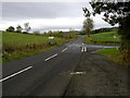
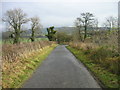
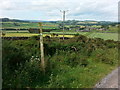
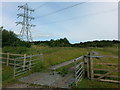
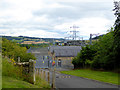
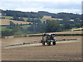
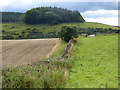
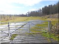
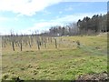
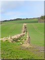
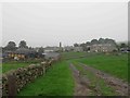
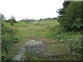
Warden is a small village and ancient civil parish located in Northumberland, North East England. The parish covers an area of 12.2 square kilometres and sits roughly 2 to 3 miles west-northwest of Hexham. You will find the village positioned at the confluence of the North Tyne and South Tyne rivers. This location gives the area a distinct rural character while maintaining proximity to larger towns. Historical records indicate the settlement encompasses sub-areas like High Warden, Nether Warden, Walwick, and Four Stones. The name derives from the Old English "weard-dun," translating to watch hill. This refers to an Iron Age hillfort that overlooked the rivers. The site likely functioned as a lookout post against ancient threats including Romans, Vikings, and Scots. Daily life in Warden revolves around significant historical landmarks. You can visit St Michael and All Angels Church, which features an 11th-century Saxon tower. This tower was built using stones possibly repurposed from Chesters Fort. The parish also contains a historic paper mill on the South Tyne that dates back to 1763. Transport links include Fourstones railway station, which offers access to the Newcastle and Carlisle Railway line. A minor road called Homers Lane connects the village to Walwick. While the Roman Stanegate route passes nearby, modern residents rely on roads for daily commuting. The area does not contain protected designations like Areas of Outstanding Natural Beauty. Instead, you will encounter specific planning constraints related to protected woodlands and nature reserves. These factors shape development possibilities within the parcel of land. Living here means embracing a setting defined by deep historical roots and river landscapes. The community benefits from a central position near the Tyne confluence without being part of a major urban centre.
- Area Type
- Parish
- Area Size
- 12.2 km²
- Population
- Not available
- Population Density
- Not available
Demographics
The age profile of Warden reveals a significantly mature population. The median age for residents stands at 70 years old. This figure indicates a community dominated by older individuals rather than families with young children. Data for the total age range confirms this skew towards senior households. You are looking at an area where the majority of people are in their later life stages. Community interactions likely centre around shared interests of this demographic rather than typical family activities. Household composition data reflects the total population structure without distinguishing between specific family types. The high median age suggests you will encounter fewer young professionals or students typically found in other parts of Northumberland. Home ownership levels in Warden reach 65 per cent of the total population. Nearly two-thirds of residents own their homes outright or have a mortgage. This percentage creates a stable demographic base dominated by long-term residents. Accommodation type statistics show the total housing stock available within the parish boundaries. You will find that rental properties make up a smaller proportion of the market compared to other urban areas. The low rental sector corresponds with the high level of home ownership. Ethnic diversity records show the total ethnic composition of the parish. Religious affiliation data covers the total population practicing various faiths or none. There are no specific minority groups or religious concentrations listed in the provided statistics. The area functions as a quiet retirement destination rather than a hub for diverse young populations. Every household represents a long-standing connection to the land and its history. The lack of younger demographics means schools may serve distant catchments for local children. You should accept this demographic reality when planning to live in Warden for retirement or quiet retirement living.
Household Size
Accommodation Type
Tenure
Ethnic Group
Religion
Household Composition
Age
Household Deprivation
NS-SEC
Explore more demographic insights in this area
Go to Demographics tabPlanning
Planning Constraints
- Flood RiskPremium
- Ramsar Wetland SitesPremium
- Area of Outstanding Natural BeautyPremium
- Protected Nature ReservePremium
- Protected WoodlandPremium