Area Overview for Hartley
Photos of Hartley

Area Information
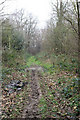
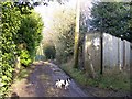
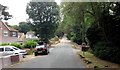
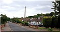
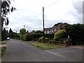
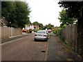
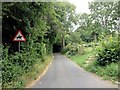
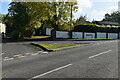
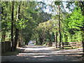
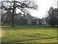
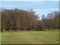
Living in Hartley offers a distinctly rural experience within the Sevenoaks district of Kent. This civil parish covers an area of 5.5 km² and sits approximately six miles south of Gravesend and Dartford. The settlement originally formed as a clearing in woodland, a legacy that remains visible in the landscape today. A population of around 1,301 residents maintains the character of a small village rather than a sprawling suburb. Historical records from the Domesday Book of 1086 list 15 families and three slaves living in the area, noting the presence of woods and arable land. All Saints' Parish Church, dating from around 1100, stands as the oldest building in the parish and provides a focal point for the community. Daily life in Hartley blends agricultural roots with later suburban development. The 20th century saw significant growth driven by the Longfield railway, which opened in 1871 and encouraged housing expansion after 1945. Former smallholdings and farms have been converted into residential properties, creating a patchwork of characterful homes among wooded settings. Features such as Hartley Wood and Old Downs reflect the area's deep history and natural beauty. While there are no major motorways or A-roads directly servicing the village, the parish council website confirms its status as a local historic site. Prospective buyers seeking a home defined by history and green space will find Hartley fits this description precisely. The location coordinates 51.392728, 0.311275 place it firmly in the South East, offering easy geographical access despite its rural isolation.
- Area Type
- Parish
- Area Size
- 5.5 km²
- Population
- Not available
- Population Density
- Not available
Demographics
The community profile of Hartley is defined by a stable, older population. The median age in the parish is 70 years, indicating a retirement demographic is central to the area's identity. This high average suggests the village serves as a destination for those seeking a quieter lifestyle away from urban pressures. Historically, the population was even smaller in the 11th century, rising to its current figure through gradual development starting in the early 20th century. Home ownership remains the dominant housing tenure within the parish. Data shows that 91% of residents own their homes outright or with a mortgage, reflecting a community where property is a long-term investment rather than a transient asset. This high rate of ownership typically correlates with greater stability and less turnover compared to rental markets. The provided data does not detail specific household compositions regarding family size or single-person households, but the age profile strongly implies a demographic skewed towards older couples and retirees. Regarding diversity, the available records do not specify the predominant ethnic group or religious affiliation for the parish. The census information provided lists these categories but offers no breakdown figures. Consequently, the narrative focuses on the demographic certainty of age and ownership rather than speculative numbers. The local government site, the Hartley Parish Council, serves the civil parish where these demographics apply. For anyone considering living in Hartley, the 91% ownership statistic is the most concrete demographic indicator available. It signals an area where property values are likely stable and where the community is established and settled over generations.
Household Size
Accommodation Type
Tenure
Ethnic Group
Religion
Household Composition
Age
Household Deprivation
NS-SEC
Explore more demographic insights in this area
Go to Demographics tabPlanning
Planning Constraints
- Flood RiskPremium
- Ramsar Wetland SitesPremium
- Area of Outstanding Natural BeautyPremium
- Protected Nature ReservePremium
- Protected WoodlandPremium