Area Overview for Halling
Photos of Halling

Area Information
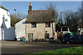
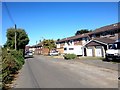
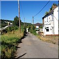
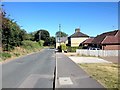
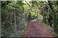
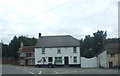
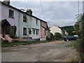
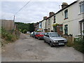
Living in Halling defines a quiet parish life within rural Sussex. This civil parish covers an area of 7.7 km², offering a compact environment where residents benefit from proximity to the countryside. The community feels established and stable, with most people seeking a settled lifestyle rather than rapid development. You will find that daily life here revolves around local amenities and the natural surroundings that characterise the parish. The setting appeals to those who prioritise peace over urban excitement. They are looking for homes in Halling that offer space and a connection to the outdoors without the constraints of a busy town centre. The parish provides a sustainable environment where the pace of life remains steady. Prospective buyers should consider the specific location within the 7.7 km² boundary. Some parts offer easy access to nearby villages while others retain a more secluded feel. The area functions as a self-contained community where neighbours know one another. It is a place where you can find retirement homes and family properties in equal measure. The simplicity of living here is the main attraction for anyone considering this parish. You will appreciate the absence of heavy traffic and the focus on local needs. Halling remains a distinct choice for those valuing a traditional rural existence.
- Area Type
- Parish
- Area Size
- 7.7 km²
- Population
- Not available
- Population Density
- Not available
Demographics
The community in Halling shows clear signs of a mature population. Data indicates a median age of 70 years, which places this area well above the national average. Most residents fall into older age groups, reflecting a strong retirement presence. This demographic profile suggests a neighbourhood where quiet and stability are the norm. Home ownership stands at 81 per cent, indicating that the majority of households have purchased their properties outright. This high level of stability means fewer tenants and a permanent local community. You will encounter few renter households compared to larger urban centres. The population structure points towards families that have grown older or individuals seeking their final homes. There is little evidence of a large young professional population seeking entry-level rentals. The household composition reflects a demographic that has settled long-term. This skewed age range creates a specific type of social dynamic where shared interests often revolve around leisure and wellness rather than childcare or commuting. For new residents, this means entering an environment where the main attractions lack the vibrancy of youth culture. The community feels established and supportive of older age groups. Every statistic here confirms a parish built for the retired population.
Household Size
Accommodation Type
Tenure
Ethnic Group
Religion
Household Composition
Age
Household Deprivation
NS-SEC
Explore more demographic insights in this area
Go to Demographics tabPlanning
Planning Constraints
- Flood RiskPremium
- Ramsar Wetland SitesPremium
- Area of Outstanding Natural BeautyPremium
- Protected Nature ReservePremium
- Protected WoodlandPremium