Area Overview for Maidstone
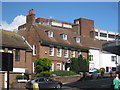
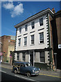
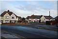
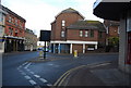
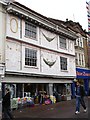
Photos of Maidstone


Area Information
Maidstone stands as the county town of Kent, situated within the Borough of Maidstone. This built-up area spans 23.8 km² and is home to a population of 36,290 residents. The district is characterised by a mix of urban vibrancy in the town centre and surrounding countryside, including orchards, farmland, and rolling hills. The landscape extends to part of the Kent Downs Area of Outstanding Natural Beauty and features hop fields and fruit farms. The borough developed significantly on 1 April 1974, merging the municipal borough with rural districts to create the current administrative boundary. Key landmarks include the Maidstone Museum, the Archbishop's Palace, and the historic estate of Leeds Castle. Residents enjoy access to the Medway Valley for scenic trails and riverside parks. The location sits on the River Medway, between the North Downs and the Weald. Strategic transport links define the area, with the M20 motorway and High Speed 1 railway crossing from west to east. You will find four motorway junctions providing access to European and London markets. The M2 motorway lies to the north, further enhancing regional connectivity. Living in Maidstone offers a distinct blend of town centre amenities and pastoral landscapes. Whether you prefer the bustle of the county town or the quiet of the Medway Valley, the area provides a diverse range of environments. The setting combines historic estates with modern developments like the Maidstone Innovation Centre. This balance makes it a practical choice for those seeking both convenience and natural beauty in Kent.
- Area Type
- Built Up Area 250
- Area Size
- 23.8 km²
- Population
- 36290
- Population Density
- 1523 people/km²
Residents of Maidstone enjoy a wide array of amenities within practical reach. The town centre is anchored by major retailers such as Tesco Maidstone, Co-op Maidstone, and Iceland Maidstone. These five notable shops form the core of local retail provision. You can find essential groceries and daily goods without needing to travel far. Transport links are equally convenient, with five notable railway stations serving the borough. Maidstone West, Maidstone East, and Maidstone Barracks Railway Station connect you to wider networks efficiently. For those who prefer air travel, there is one airport within range: Rochester Airport. Leisure and culture are centred around key landmarks like the Maidstone Museum and the Archbishop's Palace. You can enjoy a walk in the riverside parks to experience the natural beauty of the area. Historic estates and the Medway Valley offer scenic trails for those who enjoy outdoor activities. The district includes part of the Kent Downs Area of Outstanding Natural Beauty. Leeds Castle is a notable feature nearby, described as one of the loveliest castles in the world. Living in Maidstone provides easy access to both urban conveniences and historic attractions. This variety supports a balanced lifestyle for residents of all interests.
Amenities
Schools
Families considering Maidstone have access to several local educational institutions. The nearby schools include The Cedars and the Mid-Kent Behaviour Service & Education Office, both categorised as other-type facilities. For primary education, you can attend Loose Junior School or East Borough Primary School. These schools serve as key community hubs for younger children. You also have the option of Brunswick House Primary School, which holds a 'good' Ofsted rating. This specific rating confirms the school meets high standards for teaching and care. The mix of school types offers flexibility for different educational needs. While secondary options are not listed in the immediate vicinity data, the primary provision is robust. The presence of a behaviour service office indicates tailored support systems for specific student requirements. Living in Maidstone gives you proximity to these educational resources. The 'good' rating at Brunswick House provides reassurance for parents prioritising quality education. Small primary schools like Loose Junior and East Borough often foster close-knit classroom environments. You will find a range of options across the district, even if specific distances vary. The available data confirms a functional schooling infrastructure. This makes Maidstone a viable backdrop for raising children who require primary education within the town's limits.
| Rank | School | Type | Entry gender | Ages |
|---|
Explore more schools in this area
Go to Schools tabDemographics
The community within Maidstone presents a distinct demographic profile. Exactly 65% of residents own their homes, indicating a stable, owner-occupied market rather than a rental-focused area. The median age of the population is recorded at 70 years old. This figure suggests a mature demographic where long-term residents are likely to remain in their properties. Family households may be less common compared to single-person or older couples, though specific breakdowns are not detailed. The data shows the most common age range spans the total population, meaning age distribution is broad. There are no specific statistics on deprivation levels provided in the current records. However, the high home ownership rate often correlates with established neighbourhoods where residents have stayed for decades. You are joining a community where stability is a defining characteristic. The area is not dominated by transient populations, as evidenced by the ownership statistics. This stability can translate into well-maintained streets and predictable local services. The population density records an average of 1523 people per km², suggesting a moderate spread rather than crowded urban environments. You will find a mix of housing suitable for retirees and established families. The absence of young family demographics in the primary data reflects the older age profile. This environment appeals to individuals seeking a quiet, settled life rather than a rapidly changing youth hub. Historical estates and village charms align with this mature population.