Area Overview for Walmer
Photos of Walmer

Area Information
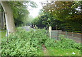
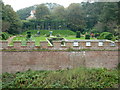
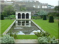
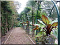
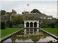
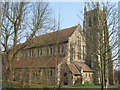
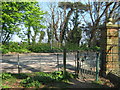
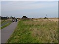
Walmer is a small civil parish on the Kent coast, covering 3.5 km² with a population of 1,645 residents. This compact area forms part of the postcodes CT14 6SH and sits at coordinates 51.214179, 1.399282. While historically distinct, Walmer has seamlessly integrated with the neighbouring town of Deal, a union that officially took place in 1936. You live in a settlement defined by its strategic location facing The Downs, the stretch of water between the shore and the treacherous Goodwin Sands. This coastal positioning shaped the village’s historical development and continues to influence the local atmosphere. The area functions as an urban extension of Deal, leveraging the port town's legacy while maintaining its own identity as a coastal community. Historical records describe Walmer as a limb of Sandwich within the medieval Cinque Ports confederation. Today, the landscape is dominated by the presence of Walmer Castle and the wide beachfront. Living in Walmer means close proximity to the sea, offering a direct connection to the coast. The village combines deep historical roots with modern convenience, situated in South East England. You are part of a community that has transitioned from a ship servicing hub to a focal point for tourism and holiday visitors.
- Area Type
- Parish
- Area Size
- 3.5 km²
- Population
- 1645
- Population Density
- 477 people/km²
Demographics
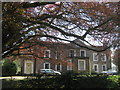
The community in Walmer is defined by an older demographic profile. The median age here is 70, and the most common age bracket relates to the total population age distribution. This indicates a settled, mature neighbourhood where residents have likely lived here for many years. Home ownership stands at 75%, which is significantly higher than the national average. This high rate suggests that most people living in Walmer purchase their homes outright rather than renting. The high ownership figure points to a stable community where families or couples build long-term roots. There are 1,645 people registered in this district, creating a tight-knight environment. The household composition spans the total population, reflecting a standard mix of family units and single occupants for an area of this size. Accommodation types cover the total stock within the parish, ranging from historic properties to modern coastal dwellings. The area does not present the demographic volatility often found in rapid growth zones. Instead, you find a consistent social fabric. The 70% homeownership rate means that flipping a property within a few years is largely irrelevant to the usual cycle of life here. This stability supports local schools and community groups. The population density reaches 477 people per square kilometre, ensuring services are nearby without the chaos of larger cities.
Household Size
Accommodation Type
Tenure
Ethnic Group
Religion
Household Composition
Age
Household Deprivation
NS-SEC
Explore more demographic insights in this area
Go to Demographics tabPlanning
Planning Constraints
- Flood RiskPremium
- Ramsar Wetland SitesPremium
- Area of Outstanding Natural BeautyPremium
- Protected Nature ReservePremium
- Protected WoodlandPremium
- Crime RiskPremium