Area Overview for Wilmington
Photos of Wilmington


Area Information
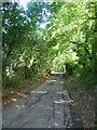
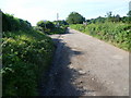
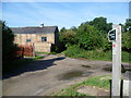
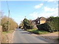
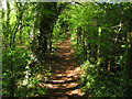
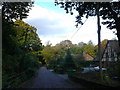
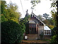
Wilmington is a civil parish located in the Dartford district of Kent, South East England. You will find this village approximately 1½ miles south-southwest of Dartford railway station. The area sits within the DA1 1HL postcode and stretches across 6.8 km² of land. Historically, it formed part of the Royal Manor of Dartford, and its roots date back to Roman times. Evidence of a third-century villa and a Saxon settlement known as Wighelm's Tun confirms its long history. By 1900, the village had established itself as a key centre for agriculture, featuring hop gardens, cherry-grounds, and plum orchards. You can still see the remains of this heritage today. The Wilmington Institute, founded in 1910 by Sir James Whitehead, stands as a notable historical feature. Burials of soldiers who died in World War I lie in the north side of the parish church. If you seek a location grounded in history yet close to transport links, Wilmington offers a suburban village setting defined by its agricultural past and enduring community ties.
- Area Type
- Parish
- Area Size
- 6.8 km²
- Population
- Not available
- Population Density
- Not available
Demographics
The community in Wilmington reflects a settled population with a distinct age profile. The median age for residents is 70, indicating a village where older generations tend to stay. Most common age groups skew towards this older demographic, which often influences local needs and pace of life. Home ownership is a defining characteristic of this parish, with 79% of households owning their properties. This high level of ownership suggests a stable community where many residents have lived in their homes for decades. Accommodation types in the area generally reflect traditional house styles suited to this demographic. The area encompasses families who value security and stability. You will not find a mix of transient residents in this civil parish; instead, you find a consistent community structure. This demographic makeup means that when you live in Wilmington, you join an established group rather than disrupting a developing trend. The stability here is supported by the fact that nearly four out of five households possess their homes outright.
Household Size
Accommodation Type
Tenure
Ethnic Group
Religion
Household Composition
Age
Household Deprivation
NS-SEC
Explore more demographic insights in this area
Go to Demographics tabPlanning
Planning Constraints
- Flood RiskPremium
- Ramsar Wetland SitesPremium
- Area of Outstanding Natural BeautyPremium
- Protected Nature ReservePremium
- Protected WoodlandPremium