Area Overview for Chestfield
Photos of Chestfield
Area Information
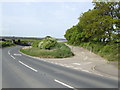
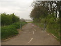
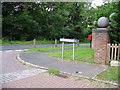
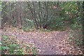
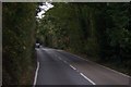
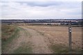
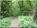
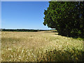
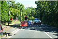
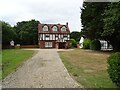
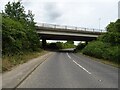
Chestfield is a civil parish situated within the Canterbury District, occupying a compact footprint of 8.1 square kilometres in South East England. Located near postcode CT5 2UB, the village sits adjacent to Swalecliffe and lies close to the north Kent coast at Whitstable. You can reach this area via Ridgeway and Primrose Way, routes defined by deep historical roots. Evidence of human activity dates back to around 3000 BC, with partial axe heads discovered in the vicinity. Early documents from 724 and 727 record land ownership by St Augustine's Abbey. The name Chestfield first appeared in the 14th century as an anglicised version of Chestvyl. The manor possibly dates to 1084 following the Norman Conquest, while Chestfield Barn originates from the 14th century. Today, this historic convergence point functions as a unified village after reinventing itself in the early 20th century. Living in Chestfield means engaging with an environment where Church lands from the 6th century and Peasants' Revolt history from 1381 remain part of the local narrative. The Chestfield Golf Club, built in 1924 on former manor estate land, features a logo referencing Odo, Bishop of Bayeux. Daily life here involves proximity to significant local landmarks like Balsar Farm, now The Barn public house, and the area offers a settled character derived from centuries of continuity.
- Area Type
- Parish
- Area Size
- 8.1 km²
- Population
- Not available
- Population Density
- Not available
Demographics
The community profile in Chestfield reflects a very settled population with a median age of 70. This demographic skew indicates that the village is primarily inhabited by older residents rather than young families or transient workers. You will find that 92% of households own their homes outright or have a substantial equity stake. This high rate of home ownership suggests a stable, long-term population unlikely to move frequently. Accommodation data confirms that the vast majority of people residing here are owner-occupiers. The age distribution shows a predominant concentration in the older age brackets, with no significant younger demographics driving recent growth. This creates a quiet neighbourhood where community structures are established and deep-rooted. The low mobility associated with high ownership levels means that local social networks tend to be tight-knit. When you look at the household composition, the data points to families who have stayed for generations or pensioners who have retired to the area. There is little indication of a transient rental market. This stability means that if you move to Chestfield, you join a cohort of neighbours who approach the village as a permanent home rather than a temporary base.
Household Size
Accommodation Type
Tenure
Ethnic Group
Religion
Household Composition
Age
Household Deprivation
NS-SEC
Explore more demographic insights in this area
Go to Demographics tabPlanning
Planning Constraints
- Flood RiskPremium
- Ramsar Wetland SitesPremium
- Area of Outstanding Natural BeautyPremium
- Protected Nature ReservePremium
- Protected WoodlandPremium
- Crime RiskPremium