Area Overview for HP9 1HT
Photos of HP9 1HT
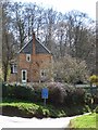
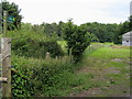
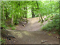
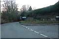
23 photos from this area
Area Information
Key information about the HP9 1HT including its size, population, and administrative classification.
- Area Type
- Postcode
- Area Size
- 4.9 hectares
- Population
- 1378
- Population Density
- 1504 people/km²
House Prices in HP9 1HT
15
Properties
£1,527,000
Average Sold Price
£940,000
Lowest Price
£1,950,000
Highest Price
Showing 15 properties
| Address | Type | Beds | Baths | Last Sale Price | Last Sale Date | |
|---|---|---|---|---|---|---|
| 116 Gregories Road, Beaconsfield, HP9 1HT | Detached | 4 | 2 | £1,785,000 | May 2025 | |
| 128 Gregories Road, Beaconsfield, HP9 1HT | Detached | 6 | 5 | £1,950,000 | Aug 2024 | |
| 112 Gregories Road, Beaconsfield, HP9 1HT | Detached | 6 | 5 | £1,825,000 | Mar 2015 | |
| 124 Gregories Road, Beaconsfield, HP9 1HT | Detached | 4 | 1 | £1,135,000 | Jun 2014 | |
| 134 Gregories Road, Beaconsfield, HP9 1HT | Detached | - | - | £940,000 | Dec 2003 | |
| Linden House, 112D Gregories Road, Beaconsfield, HP9 1HT | Detached | 5 | 4 | - | - | |
| Birchwood, 126 Gregories Road, Beaconsfield, HP9 1HT | Detached | 4 | 2 | - | - | |
| October House, 112A Gregories Road, Beaconsfield, HP9 1HT | Detached | 5 | 3 | - | - | |
| The Flat, Chilterns Edge, 130 Gregories Road, Beaconsfield, HP9 1HT | Flat | - | - | - | - | |
| 114 Gregories Road, Beaconsfield, HP9 1HT | house | - | - | - | - |
Page 1 of 2
Energy Efficiency in HP9 1HT
Amenities
Schools
| Rank | School | Type | Entry gender | Ages |
|---|
Explore more schools in this area
Go to Schools tabDemographics
Household Size
Family (3-5 people)
most common
Accommodation Type
Houses
most common
Tenure
91
majority
Ethnic Group
White
most common
Religion
N/A
most common
Household Composition
N/A
most common
Age
47
median
Adults (30-64 years)
most common
Household Deprivation
N/A
with no deprivation
NS-SEC
64
in Lower managerial occupations
Explore more demographic insights in this area
Go to Demographics tabPlanning
Planning Constraints
- Flood RiskPremium
- Ramsar Wetland SitesPremium
- Area of Outstanding Natural BeautyPremium
- Protected Nature ReservePremium
- Protected WoodlandPremium