Area Overview for HP6 6PD
Photos of HP6 6PD

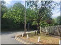
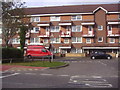
33 photos from this area
Area Information
Key information about the HP6 6PD including its size, population, and administrative classification.
- Area Type
- Postcode
- Area Size
- 8916 m²
- Population
- 2273
- Population Density
- 2054 people/km²
House Prices in HP6 6PD
12
Properties
£321,883
Average Sold Price
£105,000
Lowest Price
£610,000
Highest Price
Showing 12 properties
| Address | Type | Beds | Baths | Last Sale Price | Last Sale Date | |
|---|---|---|---|---|---|---|
| Braeside, 20 Bell Lane, Little Chalfont, HP6 6PD | Semi-detached | 3 | 1 | £570,000 | Nov 2017 | |
| 26 Bell Lane, Little Chalfont, HP6 6PD | Semi-detached | 5 | - | £610,000 | Oct 2015 | |
| 34 Bell Lane, Little Chalfont, HP6 6PD | house | - | - | £305,000 | Sep 2009 | |
| Henly, 22 Bell Lane, Little Chalfont, HP6 6PD | Semi-detached | - | - | £286,000 | Dec 2008 | |
| 38 Bell Lane, Little Chalfont, HP6 6PD | Semi-detached | - | - | £249,950 | Jan 2008 | |
| The Forge, 30 Bell Lane, Little Chalfont, HP6 6PD | Detached | - | - | £430,000 | May 2006 | |
| 36 Bell Lane, Little Chalfont, HP6 6PD | Flat | 1 | 1 | £152,000 | Apr 2004 | |
| 18 Bell Lane, Little Chalfont, HP6 6PD | Land | 1 | - | £189,000 | Apr 2002 | |
| Langley, 28 Bell Lane, Little Chalfont, HP6 6PD | Semi-detached | - | - | £105,000 | Sep 1998 | |
| Manna, 24 Bell Lane, Little Chalfont, HP6 6PD | Semi-detached | 5 | 2 | - | - |
Page 1 of 2
Energy Efficiency in HP6 6PD
Amenities
Schools
| Rank | School | Type | Entry gender | Ages |
|---|
Explore more schools in this area
Go to Schools tabDemographics
Household Size
Family (3-5 people)
most common
Accommodation Type
Houses
most common
Tenure
56
majority
Ethnic Group
White
most common
Religion
N/A
most common
Household Composition
N/A
most common
Age
47
median
Adults (30-64 years)
most common
Household Deprivation
N/A
with no deprivation
NS-SEC
45
in Lower managerial occupations
Explore more demographic insights in this area
Go to Demographics tabPlanning
Planning Constraints
- Flood RiskPremium
- Ramsar Wetland SitesPremium
- Area of Outstanding Natural BeautyPremium
- Protected Nature ReservePremium
- Protected WoodlandPremium