Area Overview for HP27 9QZ
Photos of HP27 9QZ
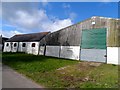
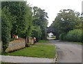
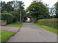
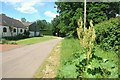

13 photos from this area
Area Information
Key information about the HP27 9QZ including its size, population, and administrative classification.
- Area Type
- Postcode
- Area Size
- 55.6 hectares
- Population
- 2142
- Population Density
- 124 people/km²
House Prices in HP27 9QZ
8
Properties
£793,014
Average Sold Price
£700,000
Lowest Price
£897,568
Highest Price
Showing 8 properties
| Address | Type | Beds | Baths | Last Sale Price | Last Sale Date | |
|---|---|---|---|---|---|---|
| Bridge House, Ilmer Lane, Ilmer, HP27 9QZ | Detached | 4 | 2 | £750,000 | Feb 2024 | |
| The Sidings, Ilmer Lane, Ilmer, HP27 9QZ | house | 4 | - | £810,000 | Nov 2022 | |
| Five Bars, Ilmer Lane, Ilmer, HP27 9QZ | Chalet | 5 | 3 | £897,568 | Dec 2020 | |
| Folly Cottage, Ilmer Lane, Ilmer, HP27 9QZ | Detached | 4 | - | £700,000 | Jun 2015 | |
| The Rosary, Ilmer Lane, Ilmer, HP27 9QZ | Detached | 4 | 4 | £807,500 | Jun 2008 | |
| Ilmer House, Ilmer Lane, Ilmer, HP27 9QZ | Detached | 3 | 3 | - | - | |
| Severalles Farm, Ilmer Lane, Ilmer, HP27 9QZ | Farm | - | - | - | - | |
| Lower Farm, Ilmer Lane, Ilmer, HP27 9QZ | Detached | - | - | - | - |
Energy Efficiency in HP27 9QZ
Amenities
Schools
| Rank | School | Type | Entry gender | Ages |
|---|
Explore more schools in this area
Go to Schools tabDemographics
Household Size
Two person
most common
Accommodation Type
Houses
most common
Tenure
80
majority
Ethnic Group
White
most common
Religion
N/A
most common
Household Composition
N/A
most common
Age
47
median
Adults (30-64 years)
most common
Household Deprivation
N/A
with no deprivation
NS-SEC
48
in Lower managerial occupations
Explore more demographic insights in this area
Go to Demographics tabPlanning
Planning Constraints
- Flood RiskPremium
- Ramsar Wetland SitesPremium
- Area of Outstanding Natural BeautyPremium
- Protected Nature ReservePremium
- Protected WoodlandPremium