Area Overview for HP22 5RE
Photos of HP22 5RE
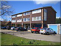
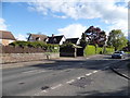
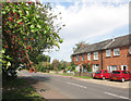
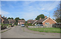
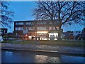
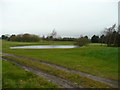
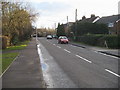
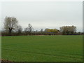
11 photos from this area
Area Information
Key information about the HP22 5RE including its size, population, and administrative classification.
- Area Type
- Postcode
- Area Size
- 2.6 hectares
- Population
- 1579
- Population Density
- 607 people/km²
House Prices in HP22 5RE
22
Properties
£319,371
Average Sold Price
£67,500
Lowest Price
£615,000
Highest Price
Showing 22 properties
| Address | Type | Beds | Baths | Last Sale Price | Last Sale Date | |
|---|---|---|---|---|---|---|
| 13 New Road, Weston Turville, HP22 5RE | Terraced | 3 | 1 | £375,000 | Sep 2025 | |
| Masquerade, 8A New Road, Weston Turville, HP22 5RE | Semi-detached | 4 | 2 | £525,000 | May 2024 | |
| 12 New Road, Weston Turville, HP22 5RE | Semi-detached | 5 | 2 | £615,000 | Oct 2023 | |
| 5 New Road, Weston Turville, HP22 5RE | house | - | - | £540,000 | Jul 2021 | |
| 10 New Road, Weston Turville, HP22 5RE | house | - | - | £310,000 | Feb 2012 | |
| 7 New Road, Weston Turville, HP22 5RE | house | - | - | £190,000 | Oct 2009 | |
| 8 New Road, Weston Turville, HP22 5RE | Semi-detached | - | - | £295,000 | May 2006 | |
| 9 New Road, Weston Turville, HP22 5RE | Terraced | - | - | £200,000 | Oct 2004 | |
| 1 New Road, Weston Turville, HP22 5RE | house | - | - | £280,000 | Apr 2004 | |
| 15A New Road, Weston Turville, HP22 5RE | Detached | 4 | 1 | £249,950 | May 2000 |
Page 1 of 3
Energy Efficiency in HP22 5RE
Amenities
Schools
| Rank | School | Type | Entry gender | Ages |
|---|
Explore more schools in this area
Go to Schools tabDemographics
Household Size
Two person
most common
Accommodation Type
Houses
most common
Tenure
82
majority
Ethnic Group
White
most common
Religion
N/A
most common
Household Composition
N/A
most common
Age
47
median
Adults (30-64 years)
most common
Household Deprivation
N/A
with no deprivation
NS-SEC
47
in Lower managerial occupations
Explore more demographic insights in this area
Go to Demographics tabPlanning
Planning Constraints
- Flood RiskPremium
- Ramsar Wetland SitesPremium
- Area of Outstanding Natural BeautyPremium
- Protected Nature ReservePremium
- Protected WoodlandPremium