Area Overview for HP22 5RA
Photos of HP22 5RA
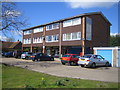
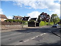
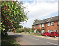
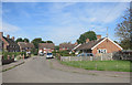
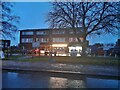
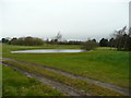
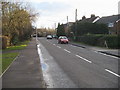
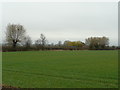
11 photos from this area
Area Information
Key information about the HP22 5RA including its size, population, and administrative classification.
- Area Type
- Postcode
- Area Size
- 4.9 hectares
- Population
- 1579
- Population Density
- 607 people/km²
House Prices in HP22 5RA
21
Properties
£487,227
Average Sold Price
£285,000
Lowest Price
£783,000
Highest Price
Showing 21 properties
| Address | Type | Beds | Baths | Last Sale Price | Last Sale Date | |
|---|---|---|---|---|---|---|
| 28 New Road, Weston Turville, HP22 5RA | Bungalow | 2 | 1 | £585,000 | Nov 2023 | |
| 35 New Road, Weston Turville, HP22 5RA | Semi-detached | 3 | 1 | £486,000 | Apr 2023 | |
| 16 New Road, Weston Turville, HP22 5RA | Bungalow | - | - | £565,000 | Apr 2023 | |
| 24 New Road, Weston Turville, HP22 5RA | Semi-detached | 4 | 1 | £515,000 | Nov 2022 | |
| 18 New Road, Weston Turville, HP22 5RA | Bungalow | 3 | 1 | £500,000 | May 2022 | |
| 33 New Road, Weston Turville, HP22 5RA | house | - | - | £460,000 | Feb 2021 | |
| 20 New Road, Weston Turville, HP22 5RA | house | - | - | £516,000 | Feb 2021 | |
| 26 New Road, Weston Turville, HP22 5RA | house | 3 | - | £372,500 | Jul 2020 | |
| 45 New Road, Weston Turville, HP22 5RA | Bungalow | - | - | £783,000 | Oct 2013 | |
| 43 New Road, Weston Turville, HP22 5RA | house | - | - | £285,000 | Sep 2013 |
Page 1 of 3
Energy Efficiency in HP22 5RA
Amenities
Schools
| Rank | School | Type | Entry gender | Ages |
|---|
Explore more schools in this area
Go to Schools tabDemographics
Household Size
Two person
most common
Accommodation Type
Houses
most common
Tenure
82
majority
Ethnic Group
White
most common
Religion
N/A
most common
Household Composition
N/A
most common
Age
47
median
Adults (30-64 years)
most common
Household Deprivation
N/A
with no deprivation
NS-SEC
47
in Lower managerial occupations
Explore more demographic insights in this area
Go to Demographics tabPlanning
Planning Constraints
- Flood RiskPremium
- Ramsar Wetland SitesPremium
- Area of Outstanding Natural BeautyPremium
- Protected Nature ReservePremium
- Protected WoodlandPremium