Area Overview for HP22 5FZ
Photos of HP22 5FZ


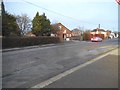
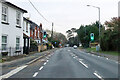

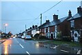
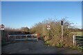
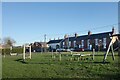


25 photos from this area
Area Information
Key information about the HP22 5FZ including its size, population, and administrative classification.
- Area Type
- Postcode
- Area Size
- 11.1 hectares
- Population
- 1520
- Population Density
- 364 people/km²
House Prices in HP22 5FZ
18
Properties
£325,567
Average Sold Price
£65,000
Lowest Price
£640,000
Highest Price
Showing 18 properties
| Address | Type | Beds | Baths | Last Sale Price | Last Sale Date | |
|---|---|---|---|---|---|---|
| 20 College Road South, Aston Clinton, HP22 5FZ | Detached | 5 | 3 | £640,000 | Sep 2025 | |
| 32 College Road South, Aston Clinton, HP22 5FZ | Detached | 4 | 2 | £600,000 | Sep 2025 | |
| 40 College Road South, Aston Clinton, HP22 5FZ | Terraced | 2 | 1 | £370,000 | Mar 2025 | |
| 38 College Road South, Aston Clinton, HP22 5FZ | Terraced | 2 | 1 | £335,000 | Aug 2024 | |
| 34 College Road South, Aston Clinton, HP22 5FZ | house | 3 | 1 | £425,000 | Jan 2022 | |
| 50 College Road South, Aston Clinton, HP22 5FZ | Terraced | 2 | - | £355,000 | Jan 2016 | |
| 30 College Road South, Aston Clinton, HP22 5FZ | house | - | - | £435,000 | Jul 2015 | |
| 42 College Road South, Aston Clinton, HP22 5FZ | house | - | - | £285,000 | Aug 2014 | |
| 22 College Road South, Aston Clinton, HP22 5FZ | Bungalow | 3 | - | £360,000 | Jun 2013 | |
| 44 College Road South, Aston Clinton, HP22 5FZ | house | 2 | - | £185,000 | Nov 2012 |
Page 1 of 2
Energy Efficiency in HP22 5FZ
Amenities
Schools
| Rank | School | Type | Entry gender | Ages |
|---|
Explore more schools in this area
Go to Schools tabDemographics
Household Size
Two person
most common
Accommodation Type
Houses
most common
Tenure
83
majority
Ethnic Group
White
most common
Religion
N/A
most common
Household Composition
N/A
most common
Age
47
median
Adults (30-64 years)
most common
Household Deprivation
N/A
with no deprivation
NS-SEC
49
in Lower managerial occupations
Explore more demographic insights in this area
Go to Demographics tabPlanning
Planning Constraints
- Flood RiskPremium
- Ramsar Wetland SitesPremium
- Area of Outstanding Natural BeautyPremium
- Protected Nature ReservePremium
- Protected WoodlandPremium