Area Overview for HP22 0AB
Photos of HP22 0AB
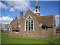
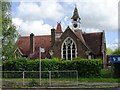
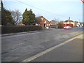
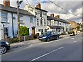
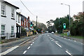
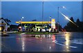
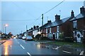
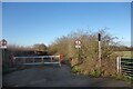
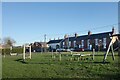
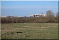
25 photos from this area
Area Information
Key information about the HP22 0AB including its size, population, and administrative classification.
- Area Type
- Postcode
- Area Size
- 8.6 hectares
- Population
- 1520
- Population Density
- 364 people/km²
House Prices in HP22 0AB
50
Properties
£650,679
Average Sold Price
£410,875
Lowest Price
£855,000
Highest Price
Showing 50 properties
| Address | Type | Beds | Baths | Last Sale Price | Last Sale Date | |
|---|---|---|---|---|---|---|
| 22 Waring Crescent, Aston Clinton, HP22 0AB | Detached | 5 | 3 | £855,000 | Jan 2025 | |
| 17 Waring Crescent, Aston Clinton, HP22 0AB | Detached | 4 | 2 | £622,000 | May 2024 | |
| 8 Waring Crescent, Aston Clinton, HP22 0AB | Detached | 3 | 2 | £537,000 | Feb 2024 | |
| 29 Waring Crescent, Aston Clinton, HP22 0AB | Detached | - | - | £850,000 | Dec 2021 | |
| 47 Waring Crescent, Aston Clinton, HP22 0AB | house | 4 | 2 | £540,000 | Nov 2021 | |
| 43 Waring Crescent, Aston Clinton, HP22 0AB | Detached | 4 | 2 | £550,000 | Nov 2021 | |
| 45 Waring Crescent, Aston Clinton, HP22 0AB | house | - | - | £760,000 | Oct 2021 | |
| 41 Waring Crescent, Aston Clinton, HP22 0AB | house | - | - | £550,000 | Oct 2021 | |
| 35 Waring Crescent, Aston Clinton, HP22 0AB | house | - | - | £760,000 | Sep 2021 | |
| 33 Waring Crescent, Aston Clinton, HP22 0AB | Detached | - | - | £850,000 | Sep 2021 |
Page 1 of 5
Energy Efficiency in HP22 0AB
Amenities
Schools
| Rank | School | Type | Entry gender | Ages |
|---|
Explore more schools in this area
Go to Schools tabDemographics
Household Size
Two person
most common
Accommodation Type
Houses
most common
Tenure
83
majority
Ethnic Group
White
most common
Religion
N/A
most common
Household Composition
N/A
most common
Age
47
median
Adults (30-64 years)
most common
Household Deprivation
N/A
with no deprivation
NS-SEC
49
in Lower managerial occupations
Explore more demographic insights in this area
Go to Demographics tabPlanning
Planning Constraints
- Flood RiskPremium
- Ramsar Wetland SitesPremium
- Area of Outstanding Natural BeautyPremium
- Protected Nature ReservePremium
- Protected WoodlandPremium